 Warner Robins
Wantagh
Bethel
Misty Hill Farm
United States
Wakonda Beach (R33) Airport
Wilmington
Poland
Miami International Airport
Warner Robins
Wantagh
Bethel
Misty Hill Farm
United States
Wakonda Beach (R33) Airport
Wilmington
Poland
Miami International Airport
Harbor's Edge Park on the map, Pompano Beach, United States
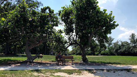
Photo
Where is located Harbor's Edge Park
Harbor's Edge Park — local attraction, which is located at 1240 NE 28th Ave, Pompano Beach, FL 33062, United States and belongs to the category — park. Average visitor rating for this place — 4.6 (according to 251 rating, information from open sources and relevant for 2022).
Exact location — Harbor's Edge Park, marked on the map with a red marker.
You can get directions to Harbor's Edge Park on the map from your location.
What else is interesting in Pompano Beach? You can see all the sights if you go to the city page.
Coordinates
Harbor's Edge Park, United States coordinates in decimal format: latitude — 26.24742878166666, longitude — -80.09240737541961. When converted to degrees, minutes, seconds Harbor's Edge Park has the following coordinates: 26°14′50.74 north latitude and -80°5′32.67 east longitude.
Nearby cities
The largest cities that are located nearby:
- Fort Lauderdale — 13 km
- Coral Springs — 15 km
- Hollywood — 25 km
- Pembroke Pines — 31 km
- Miramar — 33 km
- Hialeah — 45 km
- Miami — 53 km
- Port Saint Lucie — 117 km
- Cape Coral — 184 km
- Orlando — 282 km
- Brandon — 283 km
- Tampa — 296 km
- Saint Petersburg — 299 km
- Nassau
 (The Bahamas) — 307 km
 - Clearwater — 324 km
- Matanzas
 (Cuba) — 382 km
 - Havana (Cuba) — 404 km
- Santa Clara (Cuba) — 422 km
- Gainesville — 433 km
Distance to the capital
Distance to the capital (Washington) is about — 1437 km.