 Warner Robins
Wantagh
Bethel
Misty Hill Farm
United States
Wakonda Beach (R33) Airport
Wilmington
Poland
Miami International Airport
Warner Robins
Wantagh
Bethel
Misty Hill Farm
United States
Wakonda Beach (R33) Airport
Wilmington
Poland
Miami International Airport
Phoenix Mountains Preserve on the map, Paradise Valley, United States
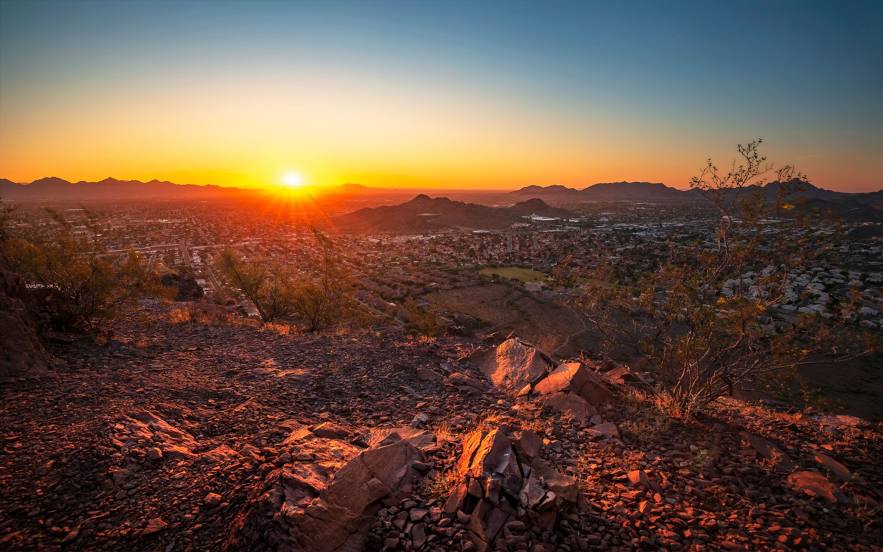
Photo
Where is located Phoenix Mountains Preserve
Phoenix Mountains Preserve — local attraction, which is located at 2701 E Squaw Peak Dr, Phoenix, AZ 85016, United States and belongs to the category — nature preserve. Average visitor rating for this place — 4.7 (according to 5305 ratings, information from open sources and relevant for 2022).
Exact location — Phoenix Mountains Preserve, marked on the map with a red marker.
You can get directions to Phoenix Mountains Preserve on the map from your location.
What else is interesting in Paradise Valley? You can see all the sights if you go to the city page.
Coordinates
Phoenix Mountains Preserve, United States coordinates in decimal format: latitude — 33.55353914586337, longitude — -112.01749777524854. When converted to degrees, minutes, seconds Phoenix Mountains Preserve has the following coordinates: 33°33′12.74 north latitude and -112°1′2.99 east longitude.
Nearby cities
The largest cities that are located nearby:
- Scottsdale — 4 km
- Tempe — 12 km
- Phoenix — 15 km
- Mesa — 16 km
- Glendale — 22 km
- Gilbert — 24 km
- Chandler — 27 km
- Peoria — 28 km
- Tucson — 173 km
- Nogales — 260 km
- San Luis Río Colorado
 (Mexico) — 290 km
 - Mexicali (Mexico) — 342 km
- Henderson — 388 km
- Las Vegas — 408 km
- North Las Vegas — 409 km
- Spring Valley — 410 km
- Ensenada (Mexico) — 475 km
- Escondido — 478 km
- Moreno Valley — 487 km
Distance to the capital
Distance to the capital (Washington) is about — 3174 km.