 Warner Robins
Wantagh
Bethel
Misty Hill Farm
United States
Wakonda Beach (R33) Airport
Wilmington
Poland
Miami International Airport
Warner Robins
Wantagh
Bethel
Misty Hill Farm
United States
Wakonda Beach (R33) Airport
Wilmington
Poland
Miami International Airport
DeNeveu Lake on the map, Fond du Lac, United States
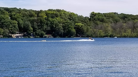
Photo
Where is located DeNeveu Lake
DeNeveu Lake — local attraction, which is located at no data and belongs to the category — -. Average visitor rating for this place — 5.0 (according to 8 ratings, information from open sources and relevant for 2022).
Exact location — DeNeveu Lake, marked on the map with a red marker.
You can get directions to DeNeveu Lake on the map from your location.
What else is interesting in Fond du Lac? You can see all the sights if you go to the city page.
Coordinates
DeNeveu Lake, United States coordinates in decimal format: latitude — 43.73256249507736, longitude — -88.39502035378666. When converted to degrees, minutes, seconds DeNeveu Lake has the following coordinates: 43°43′57.22 north latitude and -88°23′42.07 east longitude.
Nearby cities
The largest cities that are located nearby:
- Green Bay — 89 km
- Milwaukee — 92 km
- Madison — 109 km
- Rockford — 174 km
- Chicago — 220 km
- Aurora — 223 km
- Naperville — 225 km
- Grand Rapids — 242 km
- Joliet — 250 km
- South Bend — 294 km
- Lansing — 336 km
- Peoria — 354 km
- Saint Paul — 386 km
- Flint — 394 km
- Minneapolis — 400 km
- Fort Wayne — 406 km
- Ann Arbor — 419 km
- Sterling Heights — 460 km
- Warren — 464 km
Distance to the capital
Distance to the capital (Washington) is about — 1089 km.