 Warner Robins
Wantagh
Bethel
Misty Hill Farm
United States
Wakonda Beach (R33) Airport
Wilmington
Poland
Miami International Airport
Warner Robins
Wantagh
Bethel
Misty Hill Farm
United States
Wakonda Beach (R33) Airport
Wilmington
Poland
Miami International Airport
Veterans' Memorial Park on the map, Wisconsin Rapids, United States
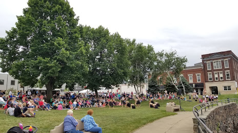
Photo
Where is located Veterans' Memorial Park
Veterans' Memorial Park — local attraction, which is located at 101-299 1st St N, Wisconsin Rapids, WI 54494, United States and belongs to the category — park. Average visitor rating for this place — 4.6 (according to 76 ratings, information from open sources and relevant for 2022).
Exact location — Veterans' Memorial Park, marked on the map with a red marker.
You can get directions to Veterans' Memorial Park on the map from your location.
What else is interesting in Wisconsin Rapids? You can see all the sights if you go to the city page.
Coordinates
Veterans' Memorial Park, United States coordinates in decimal format: latitude — 44.39168047963815, longitude — -89.82478367492872. When converted to degrees, minutes, seconds Veterans' Memorial Park has the following coordinates: 44°23′30.05 north latitude and -89°49′29.22 east longitude.
Nearby cities
The largest cities that are located nearby:
- Green Bay — 142 km
- Madison — 149 km
- Milwaukee — 214 km
- Rockford — 241 km
- Saint Paul — 264 km
- Minneapolis — 278 km
- Aurora — 315 km
- Naperville — 322 km
- Chicago — 330 km
- Joliet — 347 km
- Grand Rapids — 371 km
- Peoria — 408 km
- South Bend — 420 km
- Des Moines — 439 km
- Lansing — 465 km
- Flint — 518 km
- Fort Wayne — 534 km
- Ann Arbor — 549 km
- Sioux Falls — 562 km
Distance to the capital
Distance to the capital (Washington) is about — 1223 km.