 Warner Robins
Wantagh
Bethel
Misty Hill Farm
United States
Wakonda Beach (R33) Airport
Wilmington
Poland
Miami International Airport
Warner Robins
Wantagh
Bethel
Misty Hill Farm
United States
Wakonda Beach (R33) Airport
Wilmington
Poland
Miami International Airport
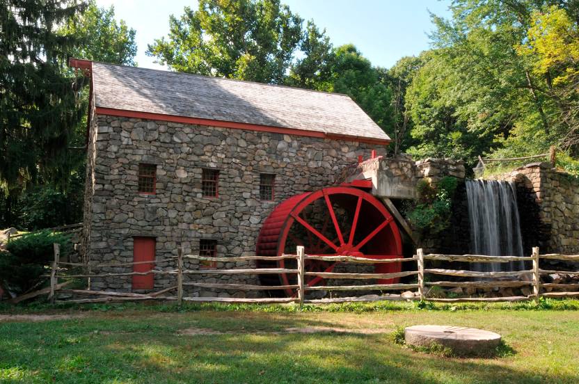
Wayside Inn Grist Mill on the map, Sudbury, United States
Photo
Where is located Wayside Inn Grist Mill
Wayside Inn Grist Mill — local attraction, which is located at 72 Wayside Inn Rd, Sudbury, MA 01776, United States and belongs to the category — historical landmark. Average visitor rating for this place — 4.8 (according to 477 ratings, information from open sources and relevant for 2022).
Exact location — Wayside Inn Grist Mill, marked on the map with a red marker.
You can get directions to Wayside Inn Grist Mill on the map from your location.
What else is interesting in Sudbury? You can see all the sights if you go to the city page.
Coordinates
Wayside Inn Grist Mill, United States coordinates in decimal format: latitude — 42.35719240243658, longitude — -71.47400007499436. When converted to degrees, minutes, seconds Wayside Inn Grist Mill has the following coordinates: 42°21′25.89 north latitude and -71°28′26.4 east longitude.
Nearby cities
The largest cities that are located nearby:
- Cambridge — 25 km
- Lowell — 29 km
- Boston — 29 km
- Worcester — 34 km
- Providence — 62 km
- Manchester — 68 km
- Amherst — 88 km
- Springfield — 101 km
- Hartford — 125 km
- Waterbury — 163 km
- New Haven — 173 km
- Bridgeport — 199 km
- Stamford — 230 km
- Yonkers — 262 km
- Paterson — 282 km
- New York — 285 km
- Brooklyn — 286 km
- Newark — 294 km
- Elizabeth — 302 km
Distance to the capital
Distance to the capital (Washington) is about — 606 km.