 Warner Robins
Wantagh
Bethel
Misty Hill Farm
United States
Wakonda Beach (R33) Airport
Wilmington
Poland
Miami International Airport
Warner Robins
Wantagh
Bethel
Misty Hill Farm
United States
Wakonda Beach (R33) Airport
Wilmington
Poland
Miami International Airport
Deer Flat National Wildlife Refuge on the map, Nampa, United States
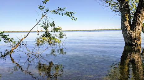
Photo
Where is located Deer Flat National Wildlife Refuge
Deer Flat National Wildlife Refuge — local attraction, which is located at 13751 Upper Embankment Rd, Nampa, ID 83686, United States and belongs to the category — wildlife refuge. Average visitor rating for this place — 4.5 (according to 1357 ratings, information from open sources and relevant for 2022).
Exact location — Deer Flat National Wildlife Refuge, marked on the map with a red marker.
You can get directions to Deer Flat National Wildlife Refuge on the map from your location.
What else is interesting in Nampa? You can see all the sights if you go to the city page.
Coordinates
Deer Flat National Wildlife Refuge, United States coordinates in decimal format: latitude — 43.558190642004, longitude — -116.66892902495587. When converted to degrees, minutes, seconds Deer Flat National Wildlife Refuge has the following coordinates: 43°33′29.49 north latitude and -116°40′8.14 east longitude.
Nearby cities
The largest cities that are located nearby:
- Boise — 29 km
- Spokane — 460 km
- West Valley City — 495 km
- Salt Lake City — 498 km
- West Jordan — 506 km
- Eugene — 521 km
- Portland — 522 km
- Reno — 523 km
- Vancouver — 525 km
- Salem — 530 km
- Provo — 552 km
- Tacoma — 603 km
- Bellevue — 616 km
- Seattle — 622 km
- Roseville — 668 km
- Sacramento — 694 km
- Kelowna
 (Canada) — 732 km
 - Victoria (Canada) — 736 km
- Abbotsford (Canada) — 739 km
Distance to the capital
Distance to the capital (Washington) is about — 3323 km.