 Warner Robins
Wantagh
Bethel
Misty Hill Farm
United States
Wakonda Beach (R33) Airport
Wilmington
Poland
Miami International Airport
Warner Robins
Wantagh
Bethel
Misty Hill Farm
United States
Wakonda Beach (R33) Airport
Wilmington
Poland
Miami International Airport
Pepper Ranch Preserve on the map, Immokalee, United States
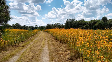
Photo
Where is located Pepper Ranch Preserve
Pepper Ranch Preserve — local attraction, which is located at 6315 Pepper Rd, Immokalee, FL 34142, United States and belongs to the category — nature preserve. Average visitor rating for this place — 4.7 (according to 94 ratings, information from open sources and relevant for 2022).
Exact location — Pepper Ranch Preserve, marked on the map with a red marker.
You can get directions to Pepper Ranch Preserve on the map from your location.
What else is interesting in Immokalee? You can see all the sights if you go to the city page.
Coordinates
Pepper Ranch Preserve, United States coordinates in decimal format: latitude — 26.437009752468132, longitude — -81.48624137541573. When converted to degrees, minutes, seconds Pepper Ranch Preserve has the following coordinates: 26°26′13.24 north latitude and -81°29′10.47 east longitude.
Nearby cities
The largest cities that are located nearby:
- Cape Coral — 55 km
- Coral Springs — 115 km
- Pembroke Pines — 120 km
- Miramar — 121 km
- Hialeah — 129 km
- Fort Lauderdale — 131 km
- Hollywood — 134 km
- Port Saint Lucie — 141 km
- Miami — 142 km
- Brandon — 188 km
- Saint Petersburg — 192 km
- Tampa — 197 km
- Clearwater — 218 km
- Orlando — 234 km
- Gainesville — 368 km
- Havana
 (Cuba) — 371 km
 - Matanzas (Cuba) — 375 km
- Jacksonville — 433 km
- Nassau
 (The Bahamas) — 435 km
Distance to the capital
Distance to the capital (Washington) is about — 1448 km.