 Warner Robins
Wantagh
Bethel
Misty Hill Farm
United States
Wakonda Beach (R33) Airport
Wilmington
Poland
Miami International Airport
Warner Robins
Wantagh
Bethel
Misty Hill Farm
United States
Wakonda Beach (R33) Airport
Wilmington
Poland
Miami International Airport
Meeman-Shelby Forest State Park on the map, Millington, United States
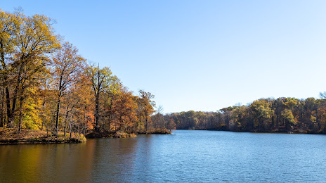
Photo
Where is located Meeman-Shelby Forest State Park
Meeman-Shelby Forest State Park — local attraction, which is located at 910 Riddick Rd, Millington, TN 38053, United States and belongs to the category — state park. Average visitor rating for this place — 4.6 (according to 1034 ratings, information from open sources and relevant for 2022).
Exact location — Meeman-Shelby Forest State Park, marked on the map with a red marker.
You can get directions to Meeman-Shelby Forest State Park on the map from your location.
What else is interesting in Millington? You can see all the sights if you go to the city page.
Coordinates
Meeman-Shelby Forest State Park, United States coordinates in decimal format: latitude — 35.34386409872607, longitude — -90.03282157520097. When converted to degrees, minutes, seconds Meeman-Shelby Forest State Park has the following coordinates: 35°20′37.91 north latitude and -90°1′58.16 east longitude.
Nearby cities
The largest cities that are located nearby:
- Memphis — 25 km
- Little Rock — 227 km
- Clarksville — 261 km
- Nashville — 293 km
- Huntsville — 308 km
- Jackson — 337 km
- Birmingham — 349 km
- Evansville — 354 km
- Springfield — 363 km
- Saint Louis — 364 km
- Chattanooga — 417 km
- Montgomery — 470 km
- Shreveport — 475 km
- Louisville — 482 km
- Atlanta — 536 km
- Knoxville — 539 km
- Mobile — 543 km
- Tulsa — 552 km
- Baton Rouge — 553 km
Distance to the capital
Distance to the capital (Washington) is about — 1217 km.