 Warner Robins
Wantagh
Bethel
Misty Hill Farm
United States
Wakonda Beach (R33) Airport
Wilmington
Poland
Miami International Airport
Warner Robins
Wantagh
Bethel
Misty Hill Farm
United States
Wakonda Beach (R33) Airport
Wilmington
Poland
Miami International Airport
The History Museum on the map, Great Falls, United States
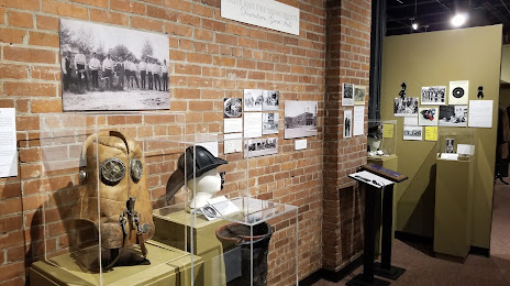
Photo
Where is located The History Museum
The History Museum — local attraction, which is located at 422 2nd St S, Great Falls, MT 59405, United States and belongs to the category — heritage museum. Average visitor rating for this place — 4.5 (according to 61 rating, information from open sources and relevant for 2022).
Exact location — The History Museum, marked on the map with a red marker.
You can get directions to The History Museum on the map from your location.
What else is interesting in Great Falls? You can see all the sights if you go to the city page.
Coordinates
The History Museum, United States coordinates in decimal format: latitude — 47.49977466171386, longitude — -111.30488977482374. When converted to degrees, minutes, seconds The History Museum has the following coordinates: 47°29′59.19 north latitude and -111°18′17.6 east longitude.
Nearby cities
The largest cities that are located nearby:
- Calgary
 (Canada) — 438 km
 - Spokane — 458 km
- Regina (Canada) — 573 km
- Boise — 583 km
- Saskatoon (Canada) — 601 km
- Kelowna (Canada) — 642 km
- Edmonton (Canada) — 684 km
- Salt Lake City — 746 km
- West Valley City — 754 km
- West Jordan — 763 km
- Provo — 803 km
- Bellevue — 814 km
- Abbotsford (Canada) — 819 km
- Seattle — 824 km
- Tacoma — 838 km
- Coquitlam (Canada) — 853 km
- Surrey (Canada) — 857 km
- Anmore (Canada) — 858 km
- Burnaby (Canada) — 865 km
Distance to the capital
Distance to the capital (Washington) is about — 2910 km.