 Warner Robins
Wantagh
Bethel
Misty Hill Farm
United States
Wakonda Beach (R33) Airport
Wilmington
Poland
Miami International Airport
Warner Robins
Wantagh
Bethel
Misty Hill Farm
United States
Wakonda Beach (R33) Airport
Wilmington
Poland
Miami International Airport
Steele County Historical Society on the map, Owatonna, United States
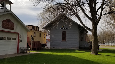
Photo
Where is located Steele County Historical Society
Steele County Historical Society — local attraction, which is located at 1700 Austin Rd, Owatonna, MN 55060, United States and belongs to the category — historical society. Average visitor rating for this place — 4.7 (according to 82 ratings, information from open sources and relevant for 2022).
Exact location — Steele County Historical Society, marked on the map with a red marker.
You can get directions to Steele County Historical Society on the map from your location.
What else is interesting in Owatonna? You can see all the sights if you go to the city page.
Coordinates
Steele County Historical Society, United States coordinates in decimal format: latitude — 44.06691438875736, longitude — -93.21683727493938. When converted to degrees, minutes, seconds Steele County Historical Society has the following coordinates: 44°4′0.89 north latitude and -93°13′0.61 east longitude.
Nearby cities
The largest cities that are located nearby:
- Saint Paul — 97 km
- Minneapolis — 99 km
- Des Moines — 277 km
- Sioux Falls — 287 km
- Madison — 329 km
- Omaha — 389 km
- Rockford — 393 km
- Green Bay — 413 km
- Milwaukee — 445 km
- Lincoln — 462 km
- Aurora — 479 km
- Peoria — 483 km
- Naperville — 492 km
- Joliet — 511 km
- Chicago — 521 km
- North Kansas City — 559 km
- Independence — 562 km
- Kansas City — 563 km
- Overland Park — 578 km
Distance to the capital
Distance to the capital (Washington) is about — 1462 km.