 Warner Robins
Wantagh
Bethel
Misty Hill Farm
United States
Wakonda Beach (R33) Airport
Wilmington
Poland
Miami International Airport
Warner Robins
Wantagh
Bethel
Misty Hill Farm
United States
Wakonda Beach (R33) Airport
Wilmington
Poland
Miami International Airport
Botanic Garden at Georgia Southern University on the map, Statesboro, United States
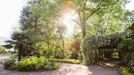
Photo
Where is located Botanic Garden at Georgia Southern University
Botanic Garden at Georgia Southern University — local attraction, which is located at 1503 Bland Ave, Statesboro, GA 30458, United States and belongs to the category — botanical garden. Average visitor rating for this place — 4.7 (according to 212 ratings, information from open sources and relevant for 2022).
Exact location — Botanic Garden at Georgia Southern University, marked on the map with a red marker.
You can get directions to Botanic Garden at Georgia Southern University on the map from your location.
What else is interesting in Statesboro? You can see all the sights if you go to the city page.
Coordinates
Botanic Garden at Georgia Southern University, United States coordinates in decimal format: latitude — 32.42070272648972, longitude — -81.7739403752775. When converted to degrees, minutes, seconds Botanic Garden at Georgia Southern University has the following coordinates: 32°25′14.53 north latitude and -81°46′26.19 east longitude.
Nearby cities
The largest cities that are located nearby:
- Savannah — 76 km
- Charleston — 176 km
- Columbia — 185 km
- Jacksonville — 234 km
- Atlanta — 279 km
- Gainesville — 314 km
- Charlotte — 319 km
- Tallahassee — 326 km
- Fayetteville — 390 km
- Montgomery — 422 km
- Winston-Salem — 426 km
- Chattanooga — 429 km
- Knoxville — 433 km
- Orlando — 434 km
- Greensboro — 438 km
- Cary — 457 km
- Raleigh — 464 km
- Durham — 469 km
- Birmingham — 478 km
Distance to the capital
Distance to the capital (Washington) is about — 839 km.