 Warner Robins
Wantagh
Bethel
Misty Hill Farm
United States
Wakonda Beach (R33) Airport
Wilmington
Poland
Miami International Airport
Warner Robins
Wantagh
Bethel
Misty Hill Farm
United States
Wakonda Beach (R33) Airport
Wilmington
Poland
Miami International Airport
Fort Zachary Taylor Historic State Park on the map, Key West, United States
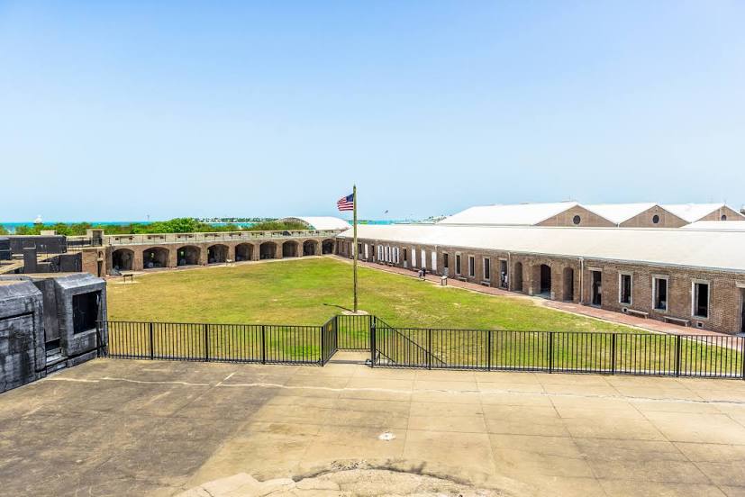
Photo
Where is located Fort Zachary Taylor Historic State Park
Fort Zachary Taylor Historic State Park — local attraction, which is located at 601 Howard England Way, Key West, FL 33040, United States and belongs to the category — state park. Average visitor rating for this place — 4.6 (according to 8215 ratings, information from open sources and relevant for 2022).
Exact location — Fort Zachary Taylor Historic State Park, marked on the map with a red marker.
You can get directions to Fort Zachary Taylor Historic State Park on the map from your location.
What else is interesting in Key West? You can see all the sights if you go to the city page.
Coordinates
Fort Zachary Taylor Historic State Park, United States coordinates in decimal format: latitude — 24.547203954434522, longitude — -81.81050500580315. When converted to degrees, minutes, seconds Fort Zachary Taylor Historic State Park has the following coordinates: 24°32′49.93 north latitude and -81°48′37.82 east longitude.
Nearby cities
The largest cities that are located nearby:
- Havana
 (Cuba) — 162 km
 - Matanzas (Cuba) — 170 km
- Miami — 207 km
- Hialeah — 208 km
- Miramar — 216 km
- Pembroke Pines — 218 km
- Cape Coral — 223 km
- Hollywood — 228 km
- Fort Lauderdale — 238 km
- Coral Springs — 242 km
- Santa Clara (Cuba) — 301 km
- Pinar del Río (Cuba) — 306 km
- Port Saint Lucie — 331 km
- Saint Petersburg — 366 km
- Brandon — 377 km
- Tampa — 381 km
- Clearwater — 390 km
- Ciego De Avila (Cuba) — 432 km
- Orlando — 442 km
Distance to the capital
Distance to the capital (Washington) is about — 1659 km.