 Warner Robins
Wantagh
Bethel
Misty Hill Farm
United States
Wakonda Beach (R33) Airport
Wilmington
Poland
Miami International Airport
Warner Robins
Wantagh
Bethel
Misty Hill Farm
United States
Wakonda Beach (R33) Airport
Wilmington
Poland
Miami International Airport
Black Arroyo Park on the map, Rio Rancho, United States
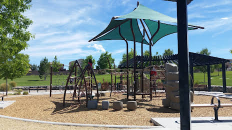
Photo
Where is located Black Arroyo Park
Black Arroyo Park — local attraction, which is located at 10836 Marble Stone Dr NW, Albuquerque, NM 87114, United States and belongs to the category — park. Average visitor rating for this place — 4.6 (according to 136 ratings, information from open sources and relevant for 2022).
Exact location — Black Arroyo Park, marked on the map with a red marker.
You can get directions to Black Arroyo Park on the map from your location.
What else is interesting in Rio Rancho? You can see all the sights if you go to the city page.
Coordinates
Black Arroyo Park, United States coordinates in decimal format: latitude — 35.23536056481198, longitude — -106.67146452467618. When converted to degrees, minutes, seconds Black Arroyo Park has the following coordinates: 35°14′7.3 north latitude and -106°40′17.27 east longitude.
Nearby cities
The largest cities that are located nearby:
- Albuquerque — 17 km
- Valencia — 48 km
- Pueblo — 379 km
- El Paso — 383 km
- Ciudad Juarez
 (Mexico) — 392 km
 - Colorado Springs — 429 km
- Amarillo — 436 km
- Lubbock — 479 km
- Lakewood — 512 km
- Gilbert — 517 km
- Mesa — 518 km
- Denver — 518 km
- Tucson — 519 km
- Aurora — 521 km
- Scottsdale — 522 km
- Arvada — 523 km
- Chandler — 524 km
- Tempe — 526 km
- Westminster — 527 km
Distance to the capital
Distance to the capital (Washington) is about — 2650 km.