
 Bokamoso
Buysdorp
Xihosana
Ga-Sekororo
Ga-Rankuwa
Three Sisters
George
Haenertsburg
Polokwane
Bokamoso
Buysdorp
Xihosana
Ga-Sekororo
Ga-Rankuwa
Three Sisters
George
Haenertsburg
Polokwane
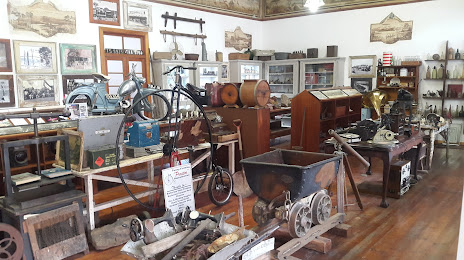
Private Mining & History Museum on the map, Barberton, South Africa
Photo
Where is located Private Mining & History Museum
Private Mining & History Museum — local attraction, which is located at 20 Pilgrim St, Barberton, 1300, South Africa and belongs to the category — museum. Average visitor rating for this place — 5.0 (according to 9 ratings, information from open sources and relevant for 2022).
Exact location — Private Mining & History Museum, marked on the map with a red marker.
You can get directions to Private Mining & History Museum on the map from your location.
What else is interesting in Barberton? You can see all the sights if you go to the city page.
Coordinates
Private Mining & History Museum, South Africa coordinates in decimal format: latitude — -25.790996054108483, longitude — 31.05559432457083. When converted to degrees, minutes, seconds Private Mining & History Museum has the following coordinates: -25°47′27.59 north latitude and 31°3′20.14 east longitude.
Nearby cities
The largest cities that are located nearby:
- Nelspruit — 34 km
- Manzini
 (Swaziland) — 87 km
 - Matola
 (Mozambique) — 142 km
 - Maputo (Mozambique) — 154 km
- Middelburg — 157 km
- Bethal — 174 km
- Phalaborwa — 203 km
- Embalenhle — 213 km
- Vryheid — 222 km
- Newcastle — 243 km
- Polokwane — 263 km
- Springs — 263 km
- Nigel — 265 km
- Mokopane — 270 km
- Benoni — 274 km
- Boksburg — 283 km
- Tembisa — 283 km
- Midrand — 291 km
- Centurion — 294 km
Distance to the capital
Distance to the capital (Pretoria) is about — 287 km.