
 Maureville
Samoëns
Gréning
Toulouse
Volx
Goudet
Méhoncourt
Saint-Hymer
Pontcarré
Maureville
Samoëns
Gréning
Toulouse
Volx
Goudet
Méhoncourt
Saint-Hymer
Pontcarré
Forêt de Sénart on the map, Combs-la-Ville, France
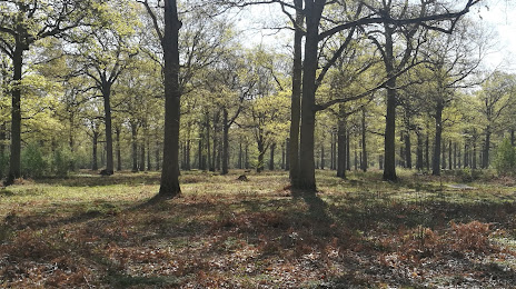
Photo
Where is located Forêt de Sénart
Forêt de Sénart — local attraction, which is located at France and belongs to the category — national forest. Average visitor rating for this place — 4.4 (according to 3435 ratings, information from open sources and relevant for 2022).
Exact location — Forêt de Sénart, marked on the map with a red marker.
You can get directions to Forêt de Sénart on the map from your location.
What else is interesting in Combs-la-Ville? You can see all the sights if you go to the city page.
Coordinates
Forêt de Sénart, France coordinates in decimal format: latitude — 48.667397293922484, longitude — 2.479837725217052. When converted to degrees, minutes, seconds Forêt de Sénart has the following coordinates: 48°40′2.63 north latitude and 2°28′47.42 east longitude.
Nearby cities
The largest cities that are located nearby:
- Boulogne-Billancourt — 30 km
- Orléans — 97 km
- Reims — 125 km
- Rouen — 136 km
- Amiens — 137 km
- Le Mans — 189 km
- Le Havre — 198 km
- Tours — 199 km
- Caen — 219 km
- Lille — 220 km
- Charleroi
 (Belgium) — 234 km
 - Dijon — 238 km
- Namur (Belgium) — 257 km
- Nancy — 265 km
- Metz — 267 km
- Angers — 268 km
- Brussels (Belgium) — 272 km
- Eastbourne
 (United Kingdom) — 281 km
 - Liège (Belgium) — 304 km
Distance to the capital
Distance to the capital (Paris) is about — 23 km.