
 Puerto de la Duquesa
La Serna de Iguña
Pumalverde
Puentenansa
La Iglesia
Casar de Periedo
Fuengirola
Renedo de Piélagos
Villabanez
Puerto de la Duquesa
La Serna de Iguña
Pumalverde
Puentenansa
La Iglesia
Casar de Periedo
Fuengirola
Renedo de Piélagos
Villabanez
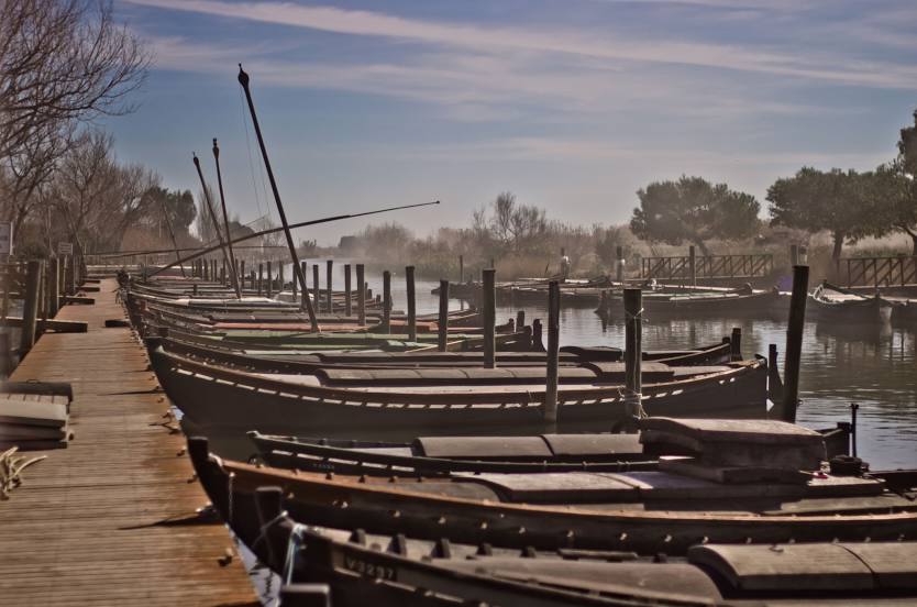
Puerto De Catarroja on the map, Picassent, Spain
Photo
Where is located Puerto De Catarroja
Puerto De Catarroja — local attraction, which is located at Carr. Puerto Catarroja, 46470 Catarroja, Valencia, Spain and belongs to the category — garden. Average visitor rating for this place — 4.5 (according to 809 ratings, information from open sources and relevant for 2022).
Exact location — Puerto De Catarroja, marked on the map with a red marker.
You can get directions to Puerto De Catarroja on the map from your location.
What else is interesting in Picassent? You can see all the sights if you go to the city page.
Coordinates
Puerto De Catarroja, Spain coordinates in decimal format: latitude — 39.39103836732236, longitude — -0.37278947508558063. When converted to degrees, minutes, seconds Puerto De Catarroja has the following coordinates: 39°23′27.74 north latitude and -0°22′22.04 east longitude.
Nearby cities
The largest cities that are located nearby:
- Valencia — 14 km
- Albacete — 127 km
- Murcia — 162 km
- Cartagena — 198 km
- Tarragona — 241 km
- Zaragoza — 255 km
- Lleida — 265 km
- Palma — 266 km
- Alcala de Henares — 274 km
- Torrejón de Ardoz — 281 km
- Getafe — 295 km
- Alcobendas — 297 km
- Leganés — 299 km
- Fuenlabrada — 300 km
- Alcorcón — 304 km
- Móstoles — 306 km
- L'Hospitalet de Llobregat — 308 km
- Terrassa — 318 km
- Santa Coloma de Gramenet — 319 km
Distance to the capital
Distance to the capital (Madrid) is about — 306 km.