
 Maureville
Samoëns
Gréning
Toulouse
Volx
Goudet
Méhoncourt
Saint-Hymer
Pontcarré
Maureville
Samoëns
Gréning
Toulouse
Volx
Goudet
Méhoncourt
Saint-Hymer
Pontcarré
Place du Trocadero on the map, La Garenne-Colombes, France
Photo
Where is located Place du Trocadero
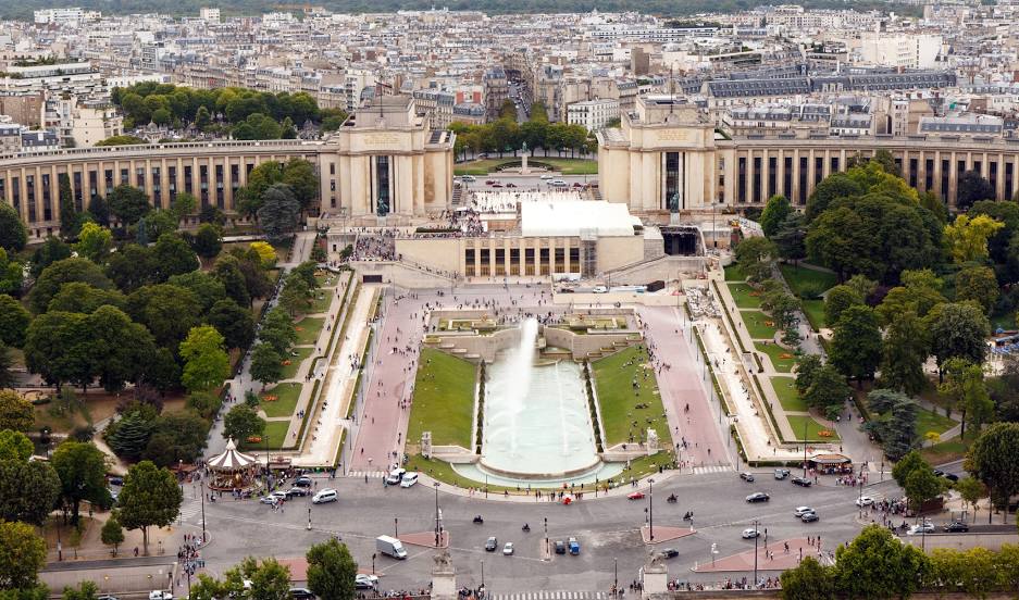
Place du Trocadero — local attraction, which is located at Place du Trocadéro, 75016 Paris, France and belongs to the category — building. Average visitor rating for this place — 4.6 (according to 5341 rating, information from open sources and relevant for 2022).
Exact location — Place du Trocadero, marked on the map with a red marker.
You can get directions to Place du Trocadero on the map from your location.
What else is interesting in La Garenne-Colombes? You can see all the sights if you go to the city page.
Coordinates
Place du Trocadero, France coordinates in decimal format: latitude — 48.85377272373547, longitude — 2.2536965302946386. When converted to degrees, minutes, seconds Place du Trocadero has the following coordinates: 48°51′13.58 north latitude and 2°15′13.31 east longitude.
Nearby cities
The largest cities that are located nearby:
- Boulogne-Billancourt — 7 km
- Rouen — 101 km
- Amiens — 109 km
- Orléans — 114 km
- Reims — 135 km
- Le Havre — 167 km
- Le Mans — 181 km
- Caen — 191 km
- Lille — 199 km
- Tours — 204 km
- Charleroi
 (Belgium) — 227 km
 - Eastbourne
 (United Kingdom) — 247 km
 - Namur (Belgium) — 253 km
- Brussels (Belgium) — 260 km
- Angers — 263 km
- Dijon — 273 km
- Metz — 285 km
- Nancy — 289 km
- Antwerp (Belgium) — 296 km
Distance to the capital
Distance to the capital (Paris) is about — 7 km.