 Warner Robins
Wantagh
Bethel
Misty Hill Farm
United States
Wakonda Beach (R33) Airport
Wilmington
Poland
Miami International Airport
Warner Robins
Wantagh
Bethel
Misty Hill Farm
United States
Wakonda Beach (R33) Airport
Wilmington
Poland
Miami International Airport
The Parklands of Floyds Fork on the map, Fort Knox, United States
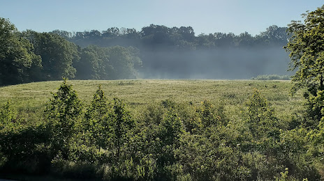
Photo
Where is located The Parklands of Floyds Fork
The Parklands of Floyds Fork — local attraction, which is located at Beckley Creek Pkwy, Louisville, KY 40245, United States and belongs to the category — park. Average visitor rating for this place — 4.8 (according to 454 ratings, information from open sources and relevant for 2022).
Exact location — The Parklands of Floyds Fork, marked on the map with a red marker.
You can get directions to The Parklands of Floyds Fork on the map from your location.
What else is interesting in Fort Knox? You can see all the sights if you go to the city page.
Coordinates
The Parklands of Floyds Fork, United States coordinates in decimal format: latitude — 37.91606619127039, longitude — -85.95631127512884. When converted to degrees, minutes, seconds The Parklands of Floyds Fork has the following coordinates: 37°54′57.84 north latitude and -85°57′22.72 east longitude.
Nearby cities
The largest cities that are located nearby:
- Louisville — 45 km
- Evansville — 140 km
- Cincinnati — 184 km
- Clarksville — 194 km
- Nashville — 204 km
- Indianapolis — 209 km
- Knoxville — 280 km
- Springfield — 290 km
- Chattanooga — 319 km
- Columbus — 341 km
- Huntsville — 353 km
- Fort Wayne — 360 km
- Saint Louis — 375 km
- South Bend — 420 km
- Peoria — 435 km
- Joliet — 439 km
- Chicago — 462 km
- Toledo — 463 km
- Naperville — 464 km
Distance to the capital
Distance to the capital (Washington) is about — 785 km.