
 Puerto de la Duquesa
La Serna de Iguña
Pumalverde
Puentenansa
La Iglesia
Casar de Periedo
Fuengirola
Renedo de Piélagos
Villabanez
Puerto de la Duquesa
La Serna de Iguña
Pumalverde
Puentenansa
La Iglesia
Casar de Periedo
Fuengirola
Renedo de Piélagos
Villabanez
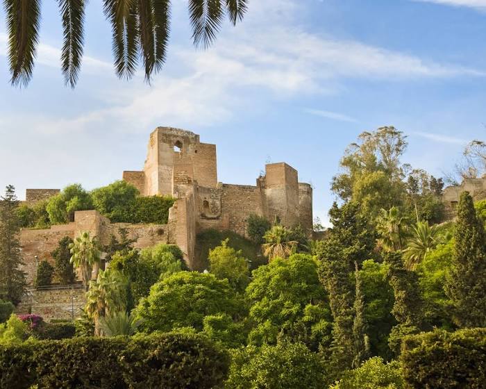
Alcazaba on the map, Málaga, Spain
Photo
Where is located Alcazaba
Alcazaba — local attraction, which is located at C/ Alcazabilla, 2, 29012 Málaga, Spain and belongs to the category — fortress. Average visitor rating for this place — 4.6 (according to 21282 ratings, information from open sources and relevant for 2022).
Exact location — Alcazaba, marked on the map with a red marker.
You can get directions to Alcazaba on the map from your location.
What else is interesting in Málaga? You can see all the sights if you go to the city page.
Coordinates
Alcazaba, Spain coordinates in decimal format: latitude — 36.72109608106426, longitude — -4.4159309751629205. When converted to degrees, minutes, seconds Alcazaba has the following coordinates: 36°43′15.95 north latitude and -4°24′57.35 east longitude.
Nearby cities
The largest cities that are located nearby:
- Marbella — 40 km
- Granada — 96 km
- Algeciras — 105 km
- Jaén — 137 km
- Córdoba — 137 km
- Dos Hermanas — 144 km
- Jerez — 146 km
- Tetouan
 (Morocco) — 146 km
 - Tangier (Morocco) — 158 km
- Cádiz — 161 km
- Almería — 180 km
- Nador (Morocco) — 218 km
- Huelva — 226 km
- Taounate (Morocco) — 237 km
- Taza (Morocco) — 275 km
- Oujda (Morocco) — 321 km
- Meknes (Morocco) — 322 km
- Cartagena — 323 km
- Badajoz — 325 km
Distance to the capital
Distance to the capital (Madrid) is about — 416 km.