
 Puerto de la Duquesa
La Serna de Iguña
Pumalverde
Puentenansa
La Iglesia
Casar de Periedo
Fuengirola
Renedo de Piélagos
Villabanez
Puerto de la Duquesa
La Serna de Iguña
Pumalverde
Puentenansa
La Iglesia
Casar de Periedo
Fuengirola
Renedo de Piélagos
Villabanez
Praia dos Barcos on the map, Sanxenxo, Spain
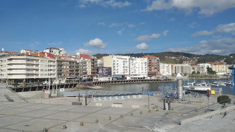
Photo
Where is located Praia dos Barcos
Praia dos Barcos — local attraction, which is located at no data and belongs to the category — -. Average visitor rating for this place — 3.5 (according to 6 ratings, information from open sources and relevant for 2022).
Exact location — Praia dos Barcos, marked on the map with a red marker.
You can get directions to Praia dos Barcos on the map from your location.
What else is interesting in Sanxenxo? You can see all the sights if you go to the city page.
Coordinates
Praia dos Barcos, Spain coordinates in decimal format: latitude — 42.3991578950153, longitude — -8.806855711091767. When converted to degrees, minutes, seconds Praia dos Barcos has the following coordinates: 42°23′56.97 north latitude and -8°48′24.68 east longitude.
Nearby cities
The largest cities that are located nearby:
- Vigo — 19 km
- Ourense — 77 km
- Braga
 (Portugal) — 100 km
 - A Coruña — 111 km
- Porto (Portugal) — 138 km
- Coimbra (Portugal) — 245 km
- Oviedo — 260 km
- León — 264 km
- Gijón — 281 km
- Salamanca — 306 km
- Valladolid — 347 km
- Amadora (Portugal) — 404 km
- Queluz (Portugal) — 405 km
- Lisbon (Portugal) — 408 km
- Burgos — 417 km
- Santander — 418 km
- Badajoz — 420 km
- Móstoles — 475 km
- Alcorcón — 477 km
Distance to the capital
Distance to the capital (Madrid) is about — 479 km.