
 Hessisch Oldendorf
Waltershausen
Goldbach
Bad Abbach
Coswig
Osterwohle
Schönborn
Osterhofen
Ahaus
Gochsheim
Böhmenkirch
Ehringshausen
Oberrot
Boll
Nidderau
Ortenburg
Gschwend
Hillscheid
Oppenheim
Hessisch Oldendorf
Waltershausen
Goldbach
Bad Abbach
Coswig
Osterwohle
Schönborn
Osterhofen
Ahaus
Gochsheim
Böhmenkirch
Ehringshausen
Oberrot
Boll
Nidderau
Ortenburg
Gschwend
Hillscheid
Oppenheim
Dingolfing on the map, Germany
Where is located Dingolfing
Exact location — Dingolfing, Lower Bavaria, Bavaria, Germany, marked on the map with a red marker.
Coordinates
Dingolfing, Germany coordinates in decimal format: latitude — 48.6434808, longitude — 12.4851983. When converted to degrees, minutes, seconds Dingolfing has the following coordinates: 48°38′36.53 north latitude and 12°29′6.71 east longitude.
Population
Dingolfing, Lower Bavaria, Bavaria, Germany, according to our data the population is — 18,733 residents, which is about 0% of the total population of the country (Germany).
Comparison of the population on the graph:
Exact time
Time zone for this location Dingolfing — UTC +2 Europe/Berlin. Exact time — saturday, 5 may 2024 year, 06 h. 01 minute.
Sunrise and sunset
Dingolfing, sunrise and sunset data for a date — saturday 4.05.2024.
| Sunrise | Sunset | Day (duration) |
|---|---|---|
| 05:48 -1 minute | 20:25 +1 minute | 14 h. 36 minutes. +2 minutes |
You can control the scale of the map using the auxiliary tools to find out exactly where it is located Dingolfing. When you change the scale of the map, the width of the ruler also changes (in kilometers and miles).
Nearby cities
The largest cities that are located nearby:
- Regensburg — 49 km
- Ingolstadt — 78 km
- Munich — 87 km
- Salzburg
 (Austria) — 101 km
 - Augsburg — 120 km
- Nuremberg — 135 km
- Pilsen
 (Czech Republic) — 137 km
 - Linz (Austria) — 138 km
- Fürth — 142 km
- Erlangen — 149 km
- Innsbruck (Austria) — 172 km
- Ulm — 185 km
- Prague (Czech Republic) — 210 km
- Würzburg — 221 km
- Reutlingen — 241 km
- Stuttgart — 241 km
- Heilbronn — 243 km
- Chemnitz — 243 km
- Gera — 249 km
Distance to neighboring capitals:
- Prague (Czech Republic) — 213 km
- Vaduz
 (Liechtenstein) — 277 km
 - Vienna (Austria) — 291 km
- Ljubljana
 (Slovenia) — 325 km
 - Bern
 (Switzerland) — 421 km
 - Brussels
 (Belgium) — 634 km
 - Amsterdam
 (Netherlands) — 678 km
 - Warsaw
 (Poland) — 723 km
 - Paris
 (France) — 743 km
 - Paris (France) — 743 km
- Rome
 (Italy) — 750 km
 - Copenhagen
 (Denmark) — 782 km
 - Minsk
 (Belarus) — 1198 km
 - Stockholm
 (Sweden) — 1237 km
 - Oslo
 (Norway) — 1258 km
 - Kyiv
 (Ukraine) — 1314 km
 - Helsinki
 (Finland) — 1509 km
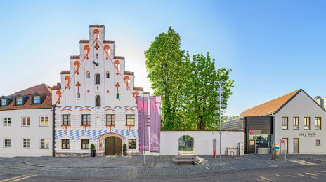
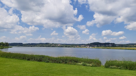
Attractions


Distance to the capital
Distance to the capital (Berlin) is about — 436 km.