
 Maureville
Samoëns
Gréning
Toulouse
Volx
Goudet
Méhoncourt
Saint-Hymer
Pontcarré
Maureville
Samoëns
Gréning
Toulouse
Volx
Goudet
Méhoncourt
Saint-Hymer
Pontcarré
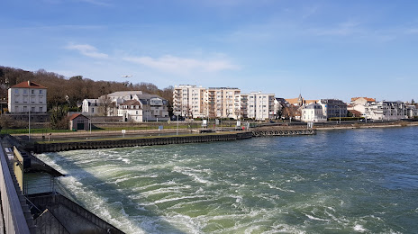
Barrage éclusé d'Ablon-sur-Seine on the map, Montgeron, France
Photo
Where is located Barrage éclusé d'Ablon-sur-Seine
Barrage éclusé d'Ablon-sur-Seine — local attraction, which is located at Écluses d'Ablon, 94480 Ablon-sur-Seine, France and belongs to the category — bridge. Average visitor rating for this place — 4.2 (according to 93 ratings, information from open sources and relevant for 2022).
Exact location — Barrage éclusé d'Ablon-sur-Seine, marked on the map with a red marker.
You can get directions to Barrage éclusé d'Ablon-sur-Seine on the map from your location.
What else is interesting in Montgeron? You can see all the sights if you go to the city page.
Coordinates
Barrage éclusé d'Ablon-sur-Seine, France coordinates in decimal format: latitude — 48.71906468745057, longitude — 2.4165913251243074. When converted to degrees, minutes, seconds Barrage éclusé d'Ablon-sur-Seine has the following coordinates: 48°43′8.63 north latitude and 2°24′59.73 east longitude.
Nearby cities
The largest cities that are located nearby:
- Boulogne-Billancourt — 22 km
- Orléans — 98 km
- Rouen — 127 km
- Reims — 129 km
- Amiens — 132 km
- Le Mans — 184 km
- Le Havre — 190 km
- Tours — 197 km
- Caen — 211 km
- Lille — 217 km
- Charleroi
 (Belgium) — 235 km
 - Dijon — 247 km
- Namur (Belgium) — 258 km
- Angers — 263 km
- Brussels (Belgium) — 272 km
- Nancy — 272 km
- Metz — 273 km
- Eastbourne
 (United Kingdom) — 274 km
 - Liège (Belgium) — 305 km
Distance to the capital
Distance to the capital (Paris) is about — 16 km.