
 Norra Grean
Asslebyn
Gillanda
Ödebyn
Håltane
Torp
Tjärtakan
Flicksäter
Dykälla
Norra Grean
Asslebyn
Gillanda
Ödebyn
Håltane
Torp
Tjärtakan
Flicksäter
Dykälla
Gröna Lund on the map, Kista, Sweden
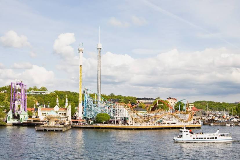
Photo
Where is located Gröna Lund
Gröna Lund — local attraction, which is located at Lilla Allmänna Gränd 9, 115 21 Stockholm, Sweden and belongs to the category — amusement park. Average visitor rating for this place — 4.3 (according to 17554 ratings, information from open sources and relevant for 2022).
Exact location — Gröna Lund, marked on the map with a red marker.
You can get directions to Gröna Lund on the map from your location.
What else is interesting in Kista? You can see all the sights if you go to the city page.
Coordinates
Gröna Lund, Sweden coordinates in decimal format: latitude — 59.32332901279528, longitude — 18.096325725526928. When converted to degrees, minutes, seconds Gröna Lund has the following coordinates: 59°19′23.98 north latitude and 18°5′46.77 east longitude.
Nearby cities
The largest cities that are located nearby:
- Stockholm — 32 km
- Uppsala — 33 km
- Västerås — 81 km
- Turku
 (Finland) — 251 km
 - Tampere (Finland) — 369 km
- Espoo (Finland) — 372 km
- Tallinn
 (Estonia) — 381 km
 - Helsinki (Finland) — 387 km
- Vantaa (Finland) — 393 km
- Oslo
 (Norway) — 403 km
 - Rīga
 (Latvia) — 472 km
 - Klaipėda
 (Lithuania) — 475 km
 - Šiauliai (Lithuania) — 523 km
- Tartu (Estonia) — 525 km
- Malmö — 542 km
- Copenhagen
 (Denmark) — 551 km
 - Aalborg (Denmark) — 562 km
- Gdynia
 (Poland) — 564 km
 - Kaliningrad
 (Russia) — 565 km
Distance to the capital
Distance to the capital (Stockholm) is about — 8 km.