 Warner Robins
Wantagh
Bethel
Misty Hill Farm
United States
Wakonda Beach (R33) Airport
Wilmington
Poland
Miami International Airport
Warner Robins
Wantagh
Bethel
Misty Hill Farm
United States
Wakonda Beach (R33) Airport
Wilmington
Poland
Miami International Airport
Boyce Mayview Park on the map, Mount Lebanon, United States
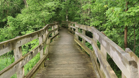
Photo
Where is located Boyce Mayview Park
Boyce Mayview Park — local attraction, which is located at 1551 Mayview Rd, Upper St Clair, PA 15241, United States and belongs to the category — park. Average visitor rating for this place — 4.7 (according to 629 ratings, information from open sources and relevant for 2022).
Exact location — Boyce Mayview Park, marked on the map with a red marker.
You can get directions to Boyce Mayview Park on the map from your location.
What else is interesting in Mount Lebanon? You can see all the sights if you go to the city page.
Coordinates
Boyce Mayview Park, United States coordinates in decimal format: latitude — 40.35859553976873, longitude — -80.06990379231125. When converted to degrees, minutes, seconds Boyce Mayview Park has the following coordinates: 40°21′30.94 north latitude and -80°4′11.65 east longitude.
Nearby cities
The largest cities that are located nearby:
- Pittsburgh — 10 km
- Akron — 146 km
- Aurora — 151 km
- Cleveland — 186 km
- Columbus — 254 km
- Boston — 273 km
- Buffalo — 295 km
- London
 (Canada) — 307 km
 - Amherst — 307 km
- Alexandria — 310 km
- Saint Catharines (Canada) — 317 km
- Baltimore — 317 km
- Hamilton (Canada) — 320 km
- Springfield — 322 km
- Toledo — 324 km
- Windsor (Canada) — 326 km
- Detroit — 328 km
- Burlington (Canada) — 329 km
- Cambridge (Canada) — 333 km
Distance to the capital
Distance to the capital (Washington) is about — 306 km.