
 La Ensenada
Obero
Cuilapa
Laguna de Montebello
Uaxactun
Melchor de Mencos
Petetan
El Subin
Patanatic
La Ensenada
Obero
Cuilapa
Laguna de Montebello
Uaxactun
Melchor de Mencos
Petetan
El Subin
Patanatic
Cerro Alux on the map, San Lucas Sacatepequez, Guatemala
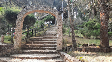
Photo
Where is located Cerro Alux
Cerro Alux — local attraction, which is located at no data and belongs to the category — -. Average visitor rating for this place — 4.6 (according to 93 ratings, information from open sources and relevant for 2022).
Exact location — Cerro Alux, marked on the map with a red marker.
You can get directions to Cerro Alux on the map from your location.
What else is interesting in San Lucas Sacatepequez? You can see all the sights if you go to the city page.
Coordinates
Cerro Alux, Guatemala coordinates in decimal format: latitude — 14.59371482673687, longitude — -90.64590132125348. When converted to degrees, minutes, seconds Cerro Alux has the following coordinates: 14°35′37.37 north latitude and -90°38′45.24 east longitude.
Nearby cities
The largest cities that are located nearby:
- Villa Nueva — 12 km
- San Juan Sacatepéquez — 12 km
- Villa Canales — 22 km
- Escuintla — 37 km
- Quetzaltenango — 95 km
- Santa Ana
 (El Salvador) — 137 km
 - Tapachula
 (Mexico) — 174 km
 - Santa Tecla (El Salvador) — 180 km
- Apopa (El Salvador) — 182 km
- Mejicanos (El Salvador) — 183 km
- San Salvador (El Salvador) — 185 km
- Soyapango (El Salvador) — 191 km
- San Miguel (El Salvador) — 295 km
- San Pedro Sula
 (Honduras) — 297 km
 - Choloma (Honduras) — 309 km
- San Cristóbal de las Casas (Mexico) — 315 km
- El Progreso (Honduras) — 317 km
- Tuxtla Gutiérrez (Mexico) — 351 km
- Tegucigalpa (Honduras) — 374 km
Distance to the capital
Distance to the capital (Guatemala City) is about — 12 km.