 Warner Robins
Wantagh
Bethel
Misty Hill Farm
United States
Wakonda Beach (R33) Airport
Wilmington
Poland
Miami International Airport
Warner Robins
Wantagh
Bethel
Misty Hill Farm
United States
Wakonda Beach (R33) Airport
Wilmington
Poland
Miami International Airport
Fargo City Civic Center on the map, Moorhead, United States
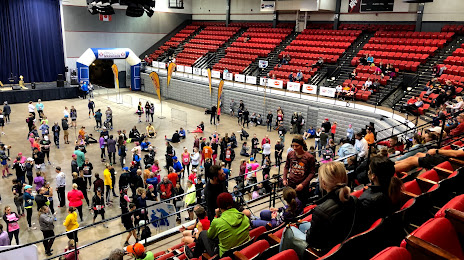
Photo
Where is located Fargo City Civic Center
Fargo City Civic Center — local attraction, which is located at 207 4th St N #4817, Fargo, ND 58102, United States and belongs to the category — arena. Average visitor rating for this place — 4.5 (according to 15 ratings, information from open sources and relevant for 2022).
Exact location — Fargo City Civic Center, marked on the map with a red marker.
You can get directions to Fargo City Civic Center on the map from your location.
What else is interesting in Moorhead? You can see all the sights if you go to the city page.
Coordinates
Fargo City Civic Center, United States coordinates in decimal format: latitude — 46.87846861077806, longitude — -96.78408747493975. When converted to degrees, minutes, seconds Fargo City Civic Center has the following coordinates: 46°52′42.49 north latitude and -96°47′2.71 east longitude.
Nearby cities
The largest cities that are located nearby:
- Winnipeg
 (Canada) — 336 km
 - Minneapolis — 345 km
- Saint Paul — 358 km
- Sioux Falls — 368 km
- Omaha — 625 km
- Des Moines — 639 km
- Lincoln — 669 km
- Regina (Canada) — 679 km
- Madison — 728 km
- Green Bay — 737 km
- Rockford — 808 km
- Milwaukee — 832 km
- Topeka — 869 km
- North Kansas City — 875 km
- Kansas City — 880 km
- Independence — 884 km
- Saskatoon (Canada) — 889 km
- Overland Park — 891 km
- Aurora — 897 km
Distance to the capital
Distance to the capital (Washington) is about — 1830 km.