 Warner Robins
Wantagh
Bethel
Misty Hill Farm
United States
Wakonda Beach (R33) Airport
Wilmington
Poland
Miami International Airport
Warner Robins
Wantagh
Bethel
Misty Hill Farm
United States
Wakonda Beach (R33) Airport
Wilmington
Poland
Miami International Airport
Remington Park on the map, Fort Drum, United States
Photo
Where is located Remington Park
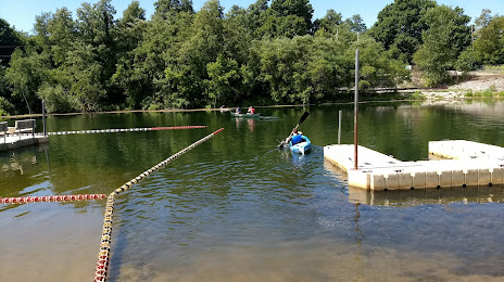
Remington Park — local attraction, which is located at Pech River Road, Fort Drum, NY 13602, United States and belongs to the category — park. Average visitor rating for this place — 4.4 (according to 150 ratings, information from open sources and relevant for 2022).
Exact location — Remington Park, marked on the map with a red marker.
You can get directions to Remington Park on the map from your location.
What else is interesting in Fort Drum? You can see all the sights if you go to the city page.
Coordinates
Remington Park, United States coordinates in decimal format: latitude — 44.054795061013124, longitude — -75.76501175393383. When converted to degrees, minutes, seconds Remington Park has the following coordinates: 44°3′17.26 north latitude and -75°45′54.04 east longitude.
Nearby cities
The largest cities that are located nearby:
- Kingston
 (Canada) — 61 km
 - Syracuse — 116 km
- Ottawa (Canada) — 151 km
- Gatineau (Canada) — 157 km
- Rochester — 180 km
- Montreal (Canada) — 233 km
- Laval (Canada) — 233 km
- Longueuil (Canada) — 238 km
- Oshawa (Canada) — 249 km
- Whitby (Canada) — 255 km
- Amherst — 274 km
- Buffalo — 285 km
- Markham (Canada) — 287 km
- Boston — 290 km
- Toronto (Canada) — 294 km
- Richmond Hill (Canada) — 295 km
- Saint Catharines (Canada) — 299 km
- Vaughan (Canada) — 301 km
- Barrie (Canada) — 314 km
Distance to the capital
Distance to the capital (Washington) is about — 582 km.