
 Maureville
Samoëns
Gréning
Toulouse
Volx
Goudet
Méhoncourt
Saint-Hymer
Pontcarré
Maureville
Samoëns
Gréning
Toulouse
Volx
Goudet
Méhoncourt
Saint-Hymer
Pontcarré
Aqueduc Saint-Clément on the map, Montpellier, France
Photo
Where is located Aqueduc Saint-Clément
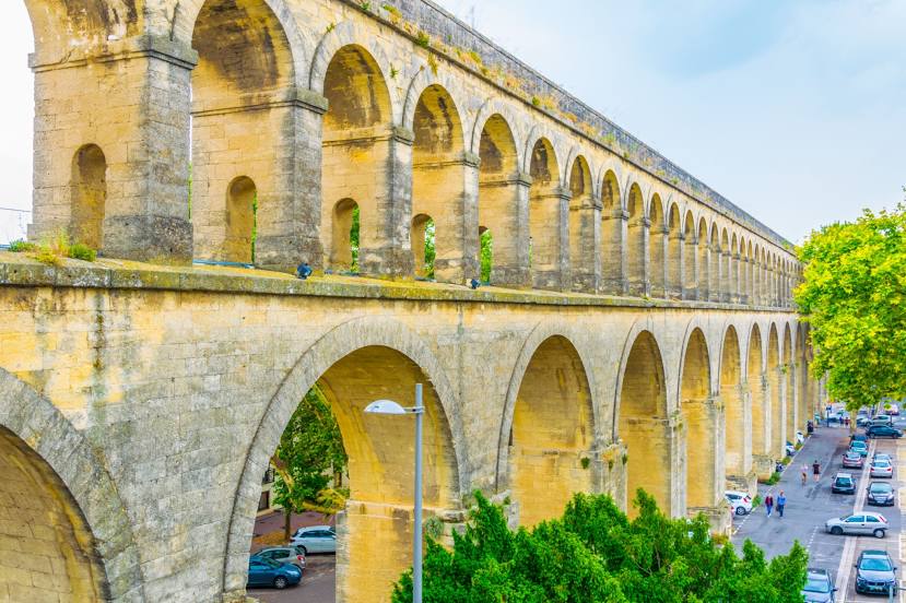
Aqueduc Saint-Clément — local attraction, which is located at Aqueduc des Arceaux, 155 Rue Hilaire Ricard 85, 34000 Montpellier, France and belongs to the category — historical landmark. Average visitor rating for this place — 4.5 (according to 881 rating, information from open sources and relevant for 2022).
Exact location — Aqueduc Saint-Clément, marked on the map with a red marker.
You can get directions to Aqueduc Saint-Clément on the map from your location.
What else is interesting in Montpellier? You can see all the sights if you go to the city page.
Coordinates
Aqueduc Saint-Clément, France coordinates in decimal format: latitude — 43.61135473886237, longitude — 3.8687452249512226. When converted to degrees, minutes, seconds Aqueduc Saint-Clément has the following coordinates: 43°36′40.88 north latitude and 3°52′7.48 east longitude.
Nearby cities
The largest cities that are located nearby:
- Nimes — 46 km
- Marseille — 125 km
- Aix-en-Provence — 126 km
- Perpignan — 129 km
- Toulon — 174 km
- Toulouse — 195 km
- Saint-Étienne — 206 km
- Grenoble — 226 km
- Clermont-Ferrand — 247 km
- Lyon — 249 km
- Villeurbanne — 251 km
- Mataró
 (Spain) — 258 km
 - Nice — 271 km
- Sabadell (Spain) — 271 km
- Terrassa (Spain) — 274 km
- Badalona (Spain) — 275 km
- Santa Coloma de Gramenet (Spain) — 276 km
- L'Hospitalet de Llobregat (Spain) — 288 km
- Limoges — 318 km
Distance to the capital
Distance to the capital (Paris) is about — 595 km.