
 Maureville
Samoëns
Gréning
Toulouse
Volx
Goudet
Méhoncourt
Saint-Hymer
Pontcarré
Maureville
Samoëns
Gréning
Toulouse
Volx
Goudet
Méhoncourt
Saint-Hymer
Pontcarré
Parc Municipal Eugène Chanlon on the map, Palaiseau, France
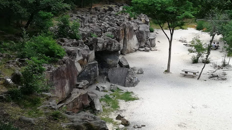
Photo
Where is located Parc Municipal Eugène Chanlon
Parc Municipal Eugène Chanlon — local attraction, which is located at 14 Rue du Rocher, 91120 Palaiseau, France and belongs to the category — city park. Average visitor rating for this place — 4.4 (according to 68 ratings, information from open sources and relevant for 2022).
Exact location — Parc Municipal Eugène Chanlon, marked on the map with a red marker.
You can get directions to Parc Municipal Eugène Chanlon on the map from your location.
What else is interesting in Palaiseau? You can see all the sights if you go to the city page.
Coordinates
Parc Municipal Eugène Chanlon, France coordinates in decimal format: latitude — 48.71010048114307, longitude — 2.199054025124002. When converted to degrees, minutes, seconds Parc Municipal Eugène Chanlon has the following coordinates: 48°42′36.36 north latitude and 2°11′56.59 east longitude.
Nearby cities
The largest cities that are located nearby:
- Boulogne-Billancourt — 14 km
- Orléans — 93 km
- Rouen — 115 km
- Amiens — 130 km
- Reims — 142 km
- Le Mans — 170 km
- Le Havre — 176 km
- Tours — 187 km
- Caen — 196 km
- Lille — 219 km
- Charleroi
 (Belgium) — 243 km
 - Angers — 250 km
- Dijon — 260 km
- Eastbourne
 (United Kingdom) — 265 km
 - Namur (Belgium) — 268 km
- Brussels (Belgium) — 278 km
- Nancy — 287 km
- Metz — 288 km
- Rennes — 297 km
Distance to the capital
Distance to the capital (Paris) is about — 20 km.