
 Maureville
Samoëns
Gréning
Toulouse
Volx
Goudet
Méhoncourt
Saint-Hymer
Pontcarré
Maureville
Samoëns
Gréning
Toulouse
Volx
Goudet
Méhoncourt
Saint-Hymer
Pontcarré
Forêt Domaniale St-Germain-en-Laye on the map, Cergy, France
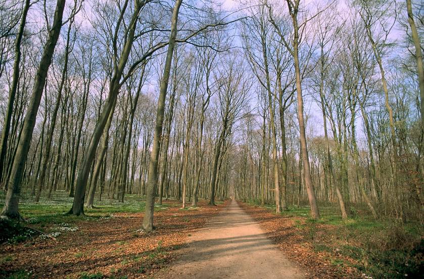
Photo
Where is located Forêt Domaniale St-Germain-en-Laye
Forêt Domaniale St-Germain-en-Laye — local attraction, which is located at 78100 Saint-Germain-en-Laye, France and belongs to the category — national forest. Average visitor rating for this place — 4.3 (according to 3796 ratings, information from open sources and relevant for 2022).
Exact location — Forêt Domaniale St-Germain-en-Laye, marked on the map with a red marker.
You can get directions to Forêt Domaniale St-Germain-en-Laye on the map from your location.
What else is interesting in Cergy? You can see all the sights if you go to the city page.
Coordinates
Forêt Domaniale St-Germain-en-Laye, France coordinates in decimal format: latitude — 48.917567609882106, longitude — 2.097968702245284. When converted to degrees, minutes, seconds Forêt Domaniale St-Germain-en-Laye has the following coordinates: 48°55′3.24 north latitude and 2°5′52.69 east longitude.
Nearby cities
The largest cities that are located nearby:
- Boulogne-Billancourt — 25 km
- Rouen — 82 km
- Amiens — 96 km
- Orléans — 126 km
- Reims — 144 km
- Le Havre — 149 km
- Caen — 176 km
- Le Mans — 179 km
- Lille — 190 km
- Tours — 209 km
- Charleroi
 (Belgium) — 227 km
 - Eastbourne
 (United Kingdom) — 228 km
 - Namur (Belgium) — 253 km
- Brussels (Belgium) — 257 km
- Angers — 261 km
- Crawley (United Kingdom) — 277 km
- Gillingham (United Kingdom) — 280 km
- Antwerp (Belgium) — 291 km
- Southend-on-Sea (United Kingdom) — 293 km
Distance to the capital
Distance to the capital (Paris) is about — 20 km.