
 Maureville
Samoëns
Gréning
Toulouse
Volx
Goudet
Méhoncourt
Saint-Hymer
Pontcarré
Maureville
Samoëns
Gréning
Toulouse
Volx
Goudet
Méhoncourt
Saint-Hymer
Pontcarré
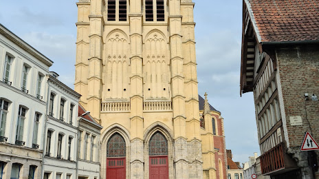
Saint-Pierre Collegiate Catholic Church at Douai on the map, Douai, France
Photo
Where is located Saint-Pierre Collegiate Catholic Church at Douai
Saint-Pierre Collegiate Catholic Church at Douai — local attraction, which is located at 64 Rue Saint-Christophe, 59500 Douai, France and belongs to the category — catholic church. Average visitor rating for this place — 4.6 (according to 174 ratings, information from open sources and relevant for 2022).
Exact location — Saint-Pierre Collegiate Catholic Church at Douai, marked on the map with a red marker.
You can get directions to Saint-Pierre Collegiate Catholic Church at Douai on the map from your location.
What else is interesting in Douai? You can see all the sights if you go to the city page.
Coordinates
Saint-Pierre Collegiate Catholic Church at Douai, France coordinates in decimal format: latitude — 50.370114463835016, longitude — 3.0809502251833316. When converted to degrees, minutes, seconds Saint-Pierre Collegiate Catholic Church at Douai has the following coordinates: 50°22′12.41 north latitude and 3°4′51.42 east longitude.
Nearby cities
The largest cities that are located nearby:
- Lille — 29 km
- Amiens — 77 km
- Charleroi
 (Belgium) — 96 km
 - Brussels (Belgium) — 104 km
- Namur (Belgium) — 127 km
- Antwerp (Belgium) — 131 km
- Reims — 141 km
- Rouen — 175 km
- Liège (Belgium) — 178 km
- Breda
 (Netherlands) — 178 km
 - Boulogne-Billancourt — 180 km
- Maastricht (Netherlands) — 190 km
- Tilburg (Netherlands) — 191 km
- Dordrecht (Netherlands) — 194 km
- Rotterdam (Netherlands) — 197 km
- Eastbourne
 (United Kingdom) — 200 km
 - Eindhoven (Netherlands) — 203 km
- The Hague (Netherlands) — 206 km
- Gillingham (United Kingdom) — 208 km
Distance to the capital
Distance to the capital (Paris) is about — 176 km.