
 Maureville
Samoëns
Gréning
Toulouse
Volx
Goudet
Méhoncourt
Saint-Hymer
Pontcarré
Maureville
Samoëns
Gréning
Toulouse
Volx
Goudet
Méhoncourt
Saint-Hymer
Pontcarré
Mont Thou on the map, Villeurbanne, France
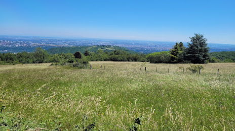
Photo
Where is located Mont Thou
Mont Thou — local attraction, which is located at no data and belongs to the category — -. Average visitor rating for this place — 4.6 (according to 389 ratings, information from open sources and relevant for 2022).
Exact location — Mont Thou, marked on the map with a red marker.
You can get directions to Mont Thou on the map from your location.
What else is interesting in Villeurbanne? You can see all the sights if you go to the city page.
Coordinates
Mont Thou, France coordinates in decimal format: latitude — 45.77115401284437, longitude — 4.8887960011987035. When converted to degrees, minutes, seconds Mont Thou has the following coordinates: 45°46′16.15 north latitude and 4°53′19.67 east longitude.
Nearby cities
The largest cities that are located nearby:
- Lyon — 4 km
- Saint-Étienne — 54 km
- Grenoble — 92 km
- Geneva
 (Switzerland) — 107 km
 - Clermont-Ferrand — 139 km
- Lausanne (Switzerland) — 156 km
- Dijon — 172 km
- Besançon — 183 km
- Nimes — 218 km
- Turin
 (Italy) — 232 km
 - Bern (Switzerland) — 233 km
- Aix-en-Provence — 252 km
- Montpellier — 252 km
- Marseille — 276 km
- Limoges — 280 km
- Basel (Switzerland) — 283 km
- Mulhouse — 284 km
- Novara (Italy) — 292 km
- Nice — 296 km
Distance to the capital
Distance to the capital (Paris) is about — 393 km.