
 Maureville
Samoëns
Gréning
Toulouse
Volx
Goudet
Méhoncourt
Saint-Hymer
Pontcarré
Maureville
Samoëns
Gréning
Toulouse
Volx
Goudet
Méhoncourt
Saint-Hymer
Pontcarré
Basilica Cathedral of Saint Denis on the map, Nanterre, France
Photo
Where is located Basilica Cathedral of Saint Denis
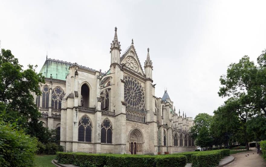
Basilica Cathedral of Saint Denis — local attraction, which is located at 1 Rue de la Légion d'Honneur, 93200 Saint-Denis, France and belongs to the category — abbey. Average visitor rating for this place — 4.6 (according to 3959 ratings, information from open sources and relevant for 2022).
Exact location — Basilica Cathedral of Saint Denis, marked on the map with a red marker.
You can get directions to Basilica Cathedral of Saint Denis on the map from your location.
What else is interesting in Nanterre? You can see all the sights if you go to the city page.
Coordinates
Basilica Cathedral of Saint Denis, France coordinates in decimal format: latitude — 48.93542593995308, longitude — 2.3597710251319497. When converted to degrees, minutes, seconds Basilica Cathedral of Saint Denis has the following coordinates: 48°56′7.53 north latitude and 2°21′35.18 east longitude.
Nearby cities
The largest cities that are located nearby:
- Boulogne-Billancourt — 6 km
- Rouen — 101 km
- Amiens — 111 km
- Orléans — 112 km
- Reims — 137 km
- Le Havre — 165 km
- Le Mans — 178 km
- Caen — 190 km
- Lille — 201 km
- Tours — 201 km
- Charleroi
 (Belgium) — 230 km
 - Eastbourne
 (United Kingdom) — 247 km
 - Namur (Belgium) — 255 km
- Angers — 260 km
- Brussels (Belgium) — 263 km
- Dijon — 274 km
- Metz — 288 km
- Nancy — 291 km
- Crawley (United Kingdom) — 296 km
Distance to the capital
Distance to the capital (Paris) is about — 9 km.