
 Maureville
Samoëns
Gréning
Toulouse
Volx
Goudet
Méhoncourt
Saint-Hymer
Pontcarré
Maureville
Samoëns
Gréning
Toulouse
Volx
Goudet
Méhoncourt
Saint-Hymer
Pontcarré
Église Sainte-Jeanne d'Arc on the map, Nice, France
Photo
Where is located Église Sainte-Jeanne d'Arc
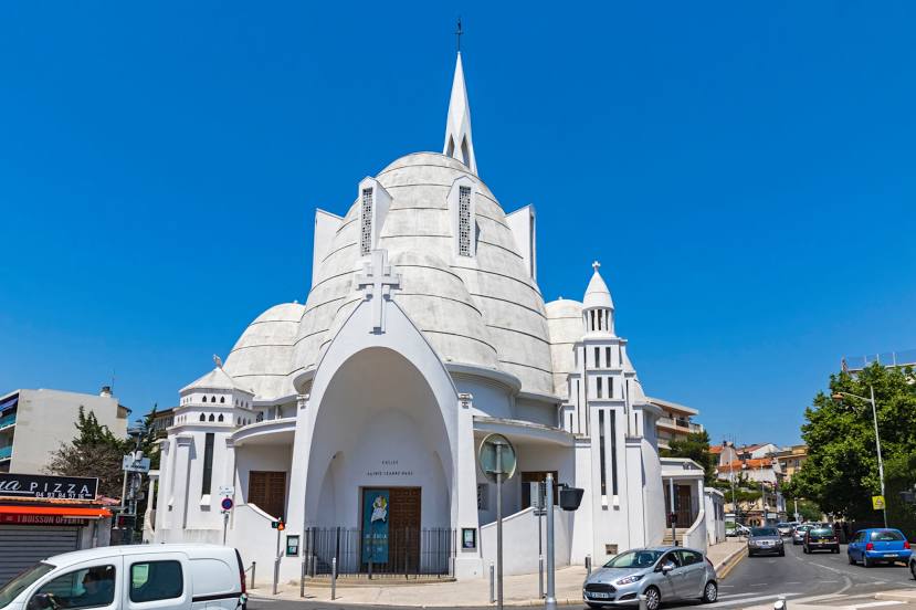
Église Sainte-Jeanne d'Arc — local attraction, which is located at 86 Av. Saint-Lambert, 06100 Nice, France and belongs to the category — catholic church. Average visitor rating for this place — 4.3 (according to 320 ratings, information from open sources and relevant for 2022).
Exact location — Église Sainte-Jeanne d'Arc, marked on the map with a red marker.
You can get directions to Église Sainte-Jeanne d'Arc on the map from your location.
What else is interesting in Nice? You can see all the sights if you go to the city page.
Coordinates
Église Sainte-Jeanne d'Arc, France coordinates in decimal format: latitude — 43.713287504748685, longitude — 7.262631124954543. When converted to degrees, minutes, seconds Église Sainte-Jeanne d'Arc has the following coordinates: 43°42′47.84 north latitude and 7°15′45.47 east longitude.
Nearby cities
The largest cities that are located nearby:
- Toulon — 126 km
- Aix-en-Provence — 147 km
- Genoa
 (Italy) — 154 km
 - Turin (Italy) — 154 km
- Marseille — 159 km
- Grenoble — 203 km
- Novara (Italy) — 219 km
- Nimes — 232 km
- Milan (Italy) — 245 km
- Livorno (Italy) — 245 km
- Monza (Italy) — 259 km
- Parma (Italy) — 269 km
- Montpellier — 271 km
- Geneva
 (Switzerland) — 288 km
 - Bergamo (Italy) — 288 km
- Villeurbanne — 292 km
- Saint-Étienne — 294 km
- Lyon — 294 km
- Brescia (Italy) — 305 km
Distance to the capital
Distance to the capital (Paris) is about — 685 km.