
 Maureville
Samoëns
Gréning
Toulouse
Volx
Goudet
Méhoncourt
Saint-Hymer
Pontcarré
Maureville
Samoëns
Gréning
Toulouse
Volx
Goudet
Méhoncourt
Saint-Hymer
Pontcarré
Royal Chapel on the map, Versailles, France
Photo
Where is located Royal Chapel
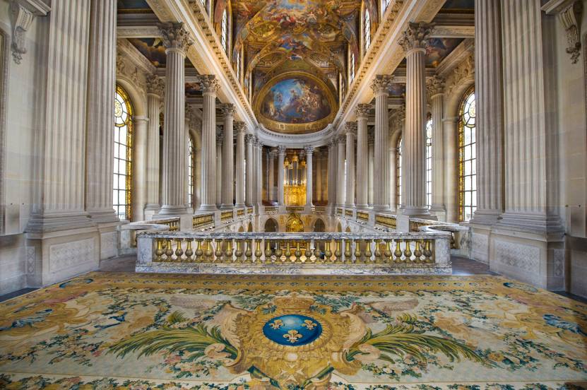
Royal Chapel — local attraction, which is located at 1 Pl. Léon Gambetta, 78000 Versailles, France and belongs to the category — catholic church. Average visitor rating for this place — 4.6 (according to 226 ratings, information from open sources and relevant for 2022).
Exact location — Royal Chapel, marked on the map with a red marker.
You can get directions to Royal Chapel on the map from your location.
What else is interesting in Versailles? You can see all the sights if you go to the city page.
Coordinates
Royal Chapel, France coordinates in decimal format: latitude — 48.80501664797344, longitude — 2.1220536251273354. When converted to degrees, minutes, seconds Royal Chapel has the following coordinates: 48°48′18.06 north latitude and 2°7′19.39 east longitude.
Nearby cities
The largest cities that are located nearby:
- Boulogne-Billancourt — 9 km
- Orléans — 101 km
- Rouen — 103 km
- Amiens — 121 km
- Reims — 146 km
- Le Havre — 164 km
- Le Mans — 168 km
- Caen — 186 km
- Tours — 189 km
- Lille — 212 km
- Charleroi
 (Belgium) — 241 km
 - Angers — 249 km
- Eastbourne
 (United Kingdom) — 253 km
 - Namur (Belgium) — 267 km
- Dijon — 273 km
- Brussels (Belgium) — 275 km
- Rennes — 291 km
- Metz — 295 km
- Nancy — 296 km
Distance to the capital
Distance to the capital (Paris) is about — 18 km.