
 Maureville
Samoëns
Gréning
Toulouse
Volx
Goudet
Méhoncourt
Saint-Hymer
Pontcarré
Maureville
Samoëns
Gréning
Toulouse
Volx
Goudet
Méhoncourt
Saint-Hymer
Pontcarré
Forêt de Verrières on the map, Boulogne-Billancourt, France
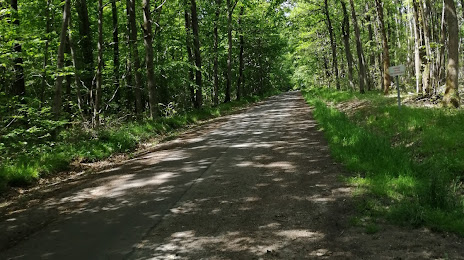
Photo
Where is located Forêt de Verrières
Forêt de Verrières — local attraction, which is located at National Forests Office and belongs to the category — -. Average visitor rating for this place — 4.1 (according to 48 ratings, information from open sources and relevant for 2022).
Exact location — Forêt de Verrières, marked on the map with a red marker.
You can get directions to Forêt de Verrières on the map from your location.
What else is interesting in Boulogne-Billancourt? You can see all the sights if you go to the city page.
Coordinates
Forêt de Verrières, France coordinates in decimal format: latitude — 48.75641325014832, longitude — 2.2427569018784452. When converted to degrees, minutes, seconds Forêt de Verrières has the following coordinates: 48°45′23.09 north latitude and 2°14′33.92 east longitude.
Nearby cities
The largest cities that are located nearby:
- Rouen — 106 km
- Orléans — 106 km
- Amiens — 117 km
- Reims — 137 km
- Le Havre — 169 km
- Le Mans — 177 km
- Caen — 192 km
- Tours — 198 km
- Lille — 206 km
- Charleroi
 (Belgium) — 233 km
 - Eastbourne
 (United Kingdom) — 253 km
 - Angers — 258 km
- Namur (Belgium) — 258 km
- Brussels (Belgium) — 267 km
- Dijon — 269 km
- Metz — 286 km
- Nancy — 288 km
- Rennes — 300 km
- Crawley (United Kingdom) — 302 km
Distance to the capital
Distance to the capital (Paris) is about — 14 km.