
 Maureville
Samoëns
Gréning
Toulouse
Volx
Goudet
Méhoncourt
Saint-Hymer
Pontcarré
Maureville
Samoëns
Gréning
Toulouse
Volx
Goudet
Méhoncourt
Saint-Hymer
Pontcarré
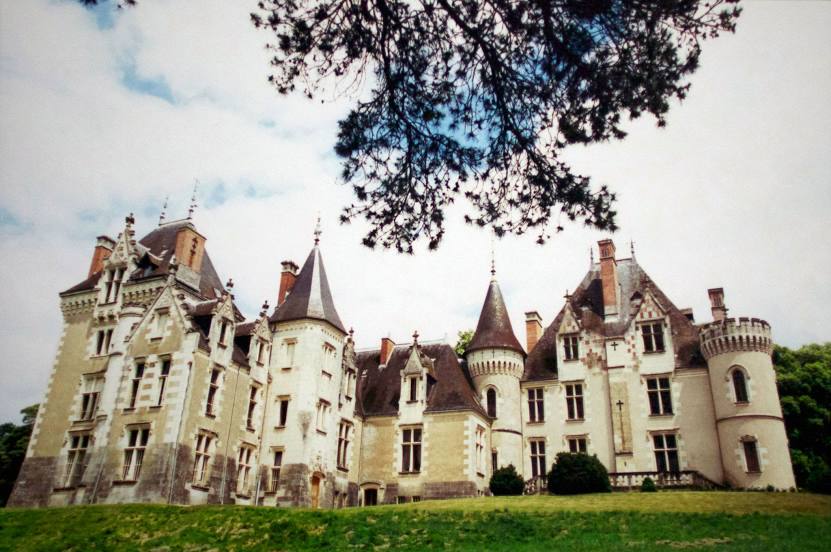
Domaine de Cande on the map, Tours, France
Photo
Where is located Domaine de Cande
Domaine de Cande — local attraction, which is located at Route du Ripault, 37260 Monts, France and belongs to the category — château. Average visitor rating for this place — 4.6 (according to 502 ratings, information from open sources and relevant for 2022).
Exact location — Domaine de Cande, marked on the map with a red marker.
You can get directions to Domaine de Cande on the map from your location.
What else is interesting in Tours? You can see all the sights if you go to the city page.
Coordinates
Domaine de Cande, France coordinates in decimal format: latitude — 47.29681659766861, longitude — 0.6643250250746319. When converted to degrees, minutes, seconds Domaine de Cande has the following coordinates: 47°17′48.54 north latitude and 0°39′51.57 east longitude.
Nearby cities
The largest cities that are located nearby:
- Le Mans — 77 km
- Angers — 94 km
- Orléans — 107 km
- Nantes — 169 km
- Limoges — 178 km
- Rennes — 192 km
- Boulogne-Billancourt — 196 km
- Caen — 212 km
- Rouen — 229 km
- Le Havre — 236 km
- Clermont-Ferrand — 257 km
- Amiens — 299 km
- Bordeaux — 299 km
- Reims — 318 km
- Dijon — 327 km
- Saint-Étienne — 359 km
- Lyon — 367 km
- Villeurbanne — 371 km
- Eastbourne
 (United Kingdom) — 374 km
Distance to the capital
Distance to the capital (Paris) is about — 214 km.