
 Maureville
Samoëns
Gréning
Toulouse
Volx
Goudet
Méhoncourt
Saint-Hymer
Pontcarré
Maureville
Samoëns
Gréning
Toulouse
Volx
Goudet
Méhoncourt
Saint-Hymer
Pontcarré
Lac de Saulx-Les-Chartreux on the map, Chilly-Mazarin, France
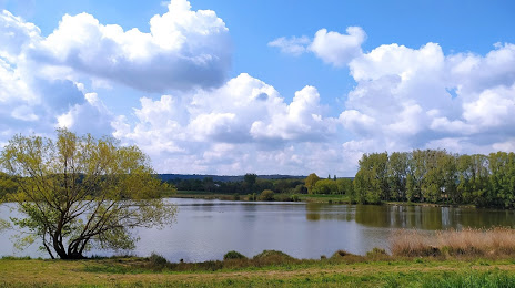
Photo
Where is located Lac de Saulx-Les-Chartreux
Lac de Saulx-Les-Chartreux — local attraction, which is located at no data and belongs to the category — -. Average visitor rating for this place — 4.1 (according to 58 ratings, information from open sources and relevant for 2022).
Exact location — Lac de Saulx-Les-Chartreux, marked on the map with a red marker.
You can get directions to Lac de Saulx-Les-Chartreux on the map from your location.
What else is interesting in Chilly-Mazarin? You can see all the sights if you go to the city page.
Coordinates
Lac de Saulx-Les-Chartreux, France coordinates in decimal format: latitude — 48.69805460390595, longitude — 2.278060246698368. When converted to degrees, minutes, seconds Lac de Saulx-Les-Chartreux has the following coordinates: 48°41′53 north latitude and 2°16′41.02 east longitude.
Nearby cities
The largest cities that are located nearby:
- Boulogne-Billancourt — 16 km
- Orléans — 94 km
- Rouen — 119 km
- Amiens — 131 km
- Reims — 138 km
- Le Mans — 174 km
- Le Havre — 181 km
- Tours — 189 km
- Caen — 201 km
- Lille — 219 km
- Charleroi
 (Belgium) — 241 km
 - Angers — 254 km
- Dijon — 256 km
- Namur (Belgium) — 265 km
- Eastbourne
 (United Kingdom) — 268 km
 - Brussels (Belgium) — 277 km
- Nancy — 283 km
- Metz — 283 km
- Rennes — 301 km
Distance to the capital
Distance to the capital (Paris) is about — 18 km.