
 Maureville
Samoëns
Gréning
Toulouse
Volx
Goudet
Méhoncourt
Saint-Hymer
Pontcarré
Maureville
Samoëns
Gréning
Toulouse
Volx
Goudet
Méhoncourt
Saint-Hymer
Pontcarré
Place Castellane on the map, Marseille, France
Photo
Where is located Place Castellane
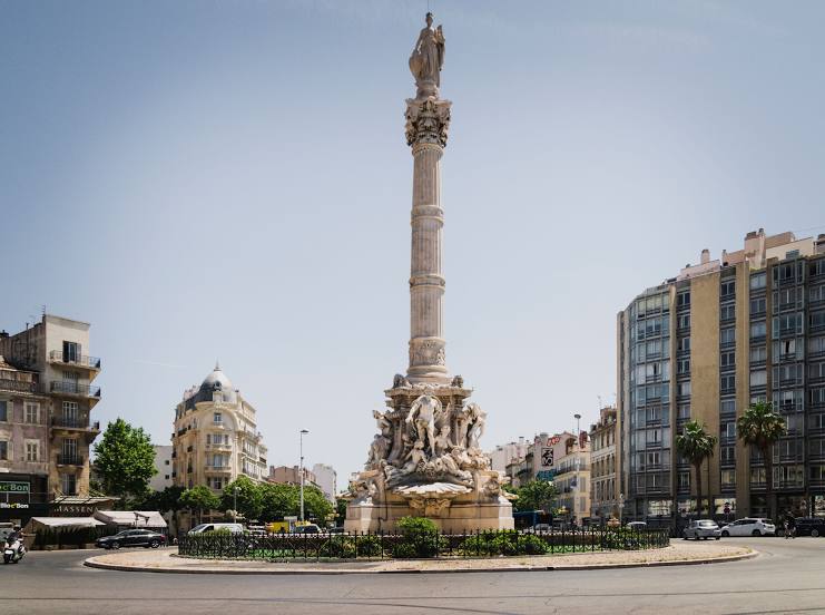
Place Castellane — local attraction, which is located at Pl. Castellane, 13006 Marseille, France and belongs to the category — historical landmark. Average visitor rating for this place — 4.2 (according to 1111 ratings, information from open sources and relevant for 2022).
Exact location — Place Castellane, marked on the map with a red marker.
You can get directions to Place Castellane on the map from your location.
What else is interesting in Marseille? You can see all the sights if you go to the city page.
Coordinates
Place Castellane, France coordinates in decimal format: latitude — 43.28587152930515, longitude — 5.383388424940726. When converted to degrees, minutes, seconds Place Castellane has the following coordinates: 43°17′9.14 north latitude and 5°23′0.2 east longitude.
Nearby cities
The largest cities that are located nearby:
- Aix-en-Provence — 27 km
- Toulon — 49 km
- Nimes — 100 km
- Montpellier — 124 km
- Nice — 158 km
- Grenoble — 211 km
- Perpignan — 212 km
- Saint-Étienne — 249 km
- Turin
 (Italy) — 267 km
 - Lyon — 276 km
- Villeurbanne — 276 km
- Genoa (Italy) — 308 km
- Mataró
 (Spain) — 310 km
 - Toulouse — 316 km
- Clermont-Ferrand — 326 km
- Geneva
 (Switzerland) — 326 km
 - Badalona (Spain) — 330 km
- Sabadell (Spain) — 332 km
- Santa Coloma de Gramenet (Spain) — 332 km
Distance to the capital
Distance to the capital (Paris) is about — 662 km.