
 Maureville
Samoëns
Gréning
Toulouse
Volx
Goudet
Méhoncourt
Saint-Hymer
Pontcarré
Maureville
Samoëns
Gréning
Toulouse
Volx
Goudet
Méhoncourt
Saint-Hymer
Pontcarré
Parc Collange on the map, Clichy, France
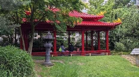
Photo
Where is located Parc Collange
Parc Collange — local attraction, which is located at 64 Rue Paul Vaillant Couturier, 92300 Levallois-Perret, France and belongs to the category — garden. Average visitor rating for this place — 4.4 (according to 291 rating, information from open sources and relevant for 2022).
Exact location — Parc Collange, marked on the map with a red marker.
You can get directions to Parc Collange on the map from your location.
What else is interesting in Clichy? You can see all the sights if you go to the city page.
Coordinates
Parc Collange, France coordinates in decimal format: latitude — 48.89744501314568, longitude — 2.2897482251306105. When converted to degrees, minutes, seconds Parc Collange has the following coordinates: 48°53′50.8 north latitude and 2°17′23.09 east longitude.
Nearby cities
The largest cities that are located nearby:
- Boulogne-Billancourt — 9 km
- Rouen — 105 km
- Amiens — 109 km
- Orléans — 115 km
- Reims — 131 km
- Le Havre — 171 km
- Le Mans — 185 km
- Caen — 196 km
- Lille — 198 km
- Tours — 206 km
- Charleroi
 (Belgium) — 225 km
 - Eastbourne
 (United Kingdom) — 250 km
 - Namur (Belgium) — 250 km
- Brussels (Belgium) — 258 km
- Angers — 266 km
- Dijon — 270 km
- Metz — 281 km
- Nancy — 284 km
- Antwerp (Belgium) — 294 km
Distance to the capital
Distance to the capital (Paris) is about — 6 km.