
 Maureville
Samoëns
Gréning
Toulouse
Volx
Goudet
Méhoncourt
Saint-Hymer
Pontcarré
Maureville
Samoëns
Gréning
Toulouse
Volx
Goudet
Méhoncourt
Saint-Hymer
Pontcarré
Parc des Buttes-Chaumont on the map, Courbevoie, France
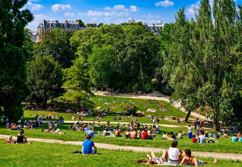
Photo
Where is located Parc des Buttes-Chaumont
Parc des Buttes-Chaumont — local attraction, which is located at 1 Rue Botzaris, 75019 Paris, France and belongs to the category — park. Average visitor rating for this place — 4.6 (according to 20307 ratings, information from open sources and relevant for 2022).
Exact location — Parc des Buttes-Chaumont, marked on the map with a red marker.
You can get directions to Parc des Buttes-Chaumont on the map from your location.
What else is interesting in Courbevoie? You can see all the sights if you go to the city page.
Coordinates
Parc des Buttes-Chaumont, France coordinates in decimal format: latitude — 48.88091430148294, longitude — 2.3826965251300045. When converted to degrees, minutes, seconds Parc des Buttes-Chaumont has the following coordinates: 48°52′51.29 north latitude and 2°22′57.71 east longitude.
Nearby cities
The largest cities that are located nearby:
- Boulogne-Billancourt — 7 km
- Rouen — 103 km
- Amiens — 110 km
- Orléans — 113 km
- Reims — 134 km
- Le Havre — 168 km
- Le Mans — 182 km
- Caen — 193 km
- Lille — 199 km
- Tours — 204 km
- Charleroi
 (Belgium) — 227 km
 - Eastbourne
 (United Kingdom) — 248 km
 - Namur (Belgium) — 253 km
- Brussels (Belgium) — 260 km
- Angers — 263 km
- Dijon — 272 km
- Metz — 284 km
- Nancy — 287 km
- Antwerp (Belgium) — 296 km
Distance to the capital
Distance to the capital (Paris) is about — 4 km.