
 Maureville
Samoëns
Gréning
Toulouse
Volx
Goudet
Méhoncourt
Saint-Hymer
Pontcarré
Maureville
Samoëns
Gréning
Toulouse
Volx
Goudet
Méhoncourt
Saint-Hymer
Pontcarré
The Confluence Park on the map, Muret, France
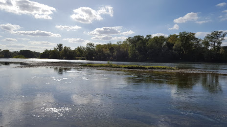
Photo
Where is located The Confluence Park
The Confluence Park — local attraction, which is located at Rte de Lacroix - Falgarde, 31120 Portet-sur-Garonne, France and belongs to the category — park. Average visitor rating for this place — 4.3 (according to 805 ratings, information from open sources and relevant for 2022).
Exact location — The Confluence Park, marked on the map with a red marker.
You can get directions to The Confluence Park on the map from your location.
What else is interesting in Muret? You can see all the sights if you go to the city page.
Coordinates
The Confluence Park, France coordinates in decimal format: latitude — 43.523336482068984, longitude — 1.4188393249483904. When converted to degrees, minutes, seconds The Confluence Park has the following coordinates: 43°31′24.01 north latitude and 1°25′7.82 east longitude.
Nearby cities
The largest cities that are located nearby:
- Toulouse — 18 km
- Perpignan — 153 km
- Montpellier — 204 km
- Lleida
 (Spain) — 212 km
 - Bordeaux — 213 km
- Terrassa (Spain) — 217 km
- Sabadell (Spain) — 221 km
- Mataró (Spain) — 232 km
- Santa Coloma de Gramenet (Spain) — 235 km
- Badalona (Spain) — 235 km
- L'Hospitalet de Llobregat (Spain) — 241 km
- Nimes — 245 km
- Pamplona (Spain) — 252 km
- Tarragona (Spain) — 259 km
- Limoges — 262 km
- San Sebastián (Spain) — 267 km
- Zaragoza (Spain) — 272 km
- Clermont-Ferrand — 290 km
- Saint-Étienne — 323 km
Distance to the capital
Distance to the capital (Paris) is about — 598 km.