
 Maureville
Samoëns
Gréning
Toulouse
Volx
Goudet
Méhoncourt
Saint-Hymer
Pontcarré
Maureville
Samoëns
Gréning
Toulouse
Volx
Goudet
Méhoncourt
Saint-Hymer
Pontcarré
Glade of the Armistice on the map, Compiègne, France
Photo
Where is located Glade of the Armistice
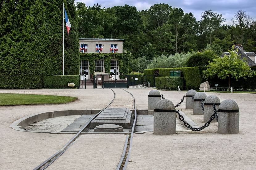
Glade of the Armistice — local attraction, which is located at Route de Soissons, 60200 Compiègne, France and belongs to the category — war museum. Average visitor rating for this place — 4.5 (according to 1082 ratings, information from open sources and relevant for 2022).
Exact location — Glade of the Armistice, marked on the map with a red marker.
You can get directions to Glade of the Armistice on the map from your location.
What else is interesting in Compiègne? You can see all the sights if you go to the city page.
Coordinates
Glade of the Armistice, France coordinates in decimal format: latitude — 49.42664288805461, longitude — 2.905488425149429. When converted to degrees, minutes, seconds Glade of the Armistice has the following coordinates: 49°25′35.91 north latitude and 2°54′19.76 east longitude.
Nearby cities
The largest cities that are located nearby:
- Amiens — 65 km
- Boulogne-Billancourt — 77 km
- Reims — 89 km
- Rouen — 124 km
- Lille — 135 km
- Charleroi
 (Belgium) — 158 km
 - Orléans — 181 km
- Namur (Belgium) — 185 km
- Brussels (Belgium) — 191 km
- Le Havre — 195 km
- Antwerp (Belgium) — 227 km
- Eastbourne
 (United Kingdom) — 232 km
 - Caen — 232 km
- Liège (Belgium) — 235 km
- Metz — 245 km
- Le Mans — 249 km
- Maastricht
 (Netherlands) — 255 km
 - Nancy — 258 km
- Gillingham (United Kingdom) — 268 km
Distance to the capital
Distance to the capital (Paris) is about — 75 km.