
 Maureville
Samoëns
Gréning
Toulouse
Volx
Goudet
Méhoncourt
Saint-Hymer
Pontcarré
Maureville
Samoëns
Gréning
Toulouse
Volx
Goudet
Méhoncourt
Saint-Hymer
Pontcarré
Hautes-Bruyères State Park on the map, Évry, France
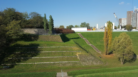
Photo
Where is located Hautes-Bruyères State Park
Hautes-Bruyères State Park — local attraction, which is located at Parc des Hautes-Bruyères, Paris, Av. de la République, 94800 Villejuif, France and belongs to the category — park. Average visitor rating for this place — 4.2 (according to 1090 ratings, information from open sources and relevant for 2022).
Exact location — Hautes-Bruyères State Park, marked on the map with a red marker.
You can get directions to Hautes-Bruyères State Park on the map from your location.
What else is interesting in Évry? You can see all the sights if you go to the city page.
Coordinates
Hautes-Bruyères State Park, France coordinates in decimal format: latitude — 48.7927495393307, longitude — 2.35189562512693. When converted to degrees, minutes, seconds Hautes-Bruyères State Park has the following coordinates: 48°47′33.9 north latitude and 2°21′6.82 east longitude.
Nearby cities
The largest cities that are located nearby:
- Boulogne-Billancourt — 27 km
- Orléans — 90 km
- Rouen — 132 km
- Reims — 134 km
- Amiens — 140 km
- Le Mans — 180 km
- Tours — 190 km
- Le Havre — 193 km
- Caen — 212 km
- Lille — 225 km
- Charleroi
 (Belgium) — 242 km
 - Dijon — 243 km
- Angers — 258 km
- Namur (Belgium) — 266 km
- Nancy — 273 km
- Metz — 276 km
- Brussels (Belgium) — 279 km
- Eastbourne
 (United Kingdom) — 280 km
 - Rennes — 309 km
Distance to the capital
Distance to the capital (Paris) is about — 7 km.