Bellevue — Allerton
Bellevue — Aragon
Bellevue — Wellman
Bellevue — Baileyville
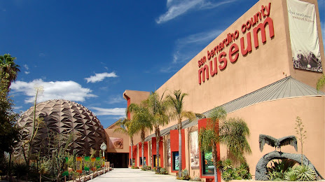
Bellevue — San Bernardino County
Bellevue — Megargel
Bellevue — Mackie's
Bellevue — Vansant
Bellevue — Suval
Bellevue — Williamstown
Bellevue — Chattanooga
Bellevue — Tonalea
Bellevue — Belvue
Bellevue — Bostwick
Bellevue — Paxinos
Bellevue — Glendora
Bellevue — Greencastle
Bellevue — Esbon
Bellevue — Spring Lake
Bellevue — Allerton
Bellevue — Aragon
Bellevue — Wellman
Bellevue — Baileyville
Bellevue — San Bernardino County
Bellevue — Megargel
Bellevue — Mackie's
Bellevue — Vansant
Bellevue — Suval
Bellevue — Williamstown
Bellevue — Chattanooga
Bellevue — Tonalea
Bellevue — Belvue
Bellevue — Bostwick
Bellevue — Paxinos
Bellevue — Glendora
Bellevue — Greencastle
Bellevue — Esbon
Bellevue — Spring Lake
Bellevue — Loma Linda distance, route on the map
Distance by car
Distance between Bellevue, Washington, United States and Loma Linda, California, United States by car is — km, or miles. To travel this distance by car, you need minute, or h.
Route on the map, driving directions
Car route Bellevue — Loma Linda was created automatically. The road on the map is shown as a blue line. By moving the markers, you can create a new route through the points you need.
Distance by plane
If you decide to take a trip Bellevue Loma Linda by plane, then you have to fly the distance — 1564 km or 970 miles. It is marked on the map with a gray line (between two points in a straight line).
Flight time
Estimated flight time Bellevue Loma Linda by plane at cruising speed 750 km / h will be — 2 h. and 5 min.
Direction of movement
United States, Bellevue — right-hand traffic. United States, Loma Linda — right-hand traffic.
Difference in time
Bellevue and Loma Linda are in the same time zone. Between them there is no time difference (UTC -7 America/Los_Angeles).
Interesting Facts
Information on alternative ways to get to your destination.
The length of this distance is about 3.9% of the total length of the equator.
The percentage of the population is clearly shown in the graph:
Bellevue — 111,927, Loma Linda — 20,802 residents (less by 91,125).
The cost of travel
Calculate the cost of the trip yourself using the fuel consumption calculator, changing the data in the table.
Calculate the cost of other distances from the starting point — Bellevue.