
 Maureville
Samoëns
Gréning
Toulouse
Volx
Goudet
Méhoncourt
Saint-Hymer
Pontcarré
Maureville
Samoëns
Gréning
Toulouse
Volx
Goudet
Méhoncourt
Saint-Hymer
Pontcarré
Dundee Parc on the map, Évry, France
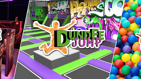
Photo
Where is located Dundee Parc
Dundee Parc — local attraction, which is located at 24 Av. Paul Maintenant, 91100 Corbeil-Essonnes, France and belongs to the category — amusement park. Average visitor rating for this place — 3.9 (according to 445 ratings, information from open sources and relevant for 2022).
Exact location — Dundee Parc, marked on the map with a red marker.
You can get directions to Dundee Parc on the map from your location.
What else is interesting in Évry? You can see all the sights if you go to the city page.
Coordinates
Dundee Parc, France coordinates in decimal format: latitude — 48.608941060023724, longitude — 2.452250075120416. When converted to degrees, minutes, seconds Dundee Parc has the following coordinates: 48°36′32.19 north latitude and 2°27′8.1 east longitude.
Nearby cities
The largest cities that are located nearby:
- Boulogne-Billancourt — 27 km
- Orléans — 90 km
- Rouen — 132 km
- Reims — 134 km
- Amiens — 140 km
- Le Mans — 180 km
- Tours — 190 km
- Le Havre — 193 km
- Caen — 212 km
- Lille — 225 km
- Charleroi
 (Belgium) — 242 km
 - Dijon — 243 km
- Angers — 258 km
- Namur (Belgium) — 266 km
- Nancy — 273 km
- Metz — 276 km
- Brussels (Belgium) — 279 km
- Eastbourne
 (United Kingdom) — 280 km
 - Rennes — 309 km
Distance to the capital
Distance to the capital (Paris) is about — 29 km.