
 Maureville
Samoëns
Gréning
Toulouse
Volx
Goudet
Méhoncourt
Saint-Hymer
Pontcarré
Maureville
Samoëns
Gréning
Toulouse
Volx
Goudet
Méhoncourt
Saint-Hymer
Pontcarré
Parc Aubert on the map, Meudon, France
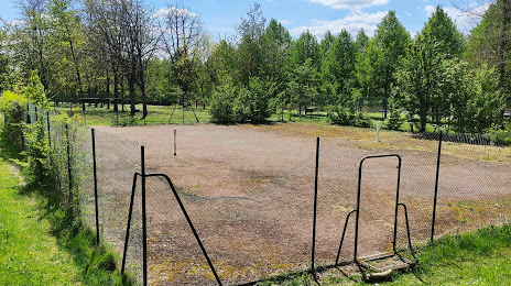
Photo
Where is located Parc Aubert
Parc Aubert — local attraction, which is located at Unnamed Road, 78150, France and belongs to the category — state park. Average visitor rating for this place — 4.4 (according to 35 ratings, information from open sources and relevant for 2022).
Exact location — Parc Aubert, marked on the map with a red marker.
You can get directions to Parc Aubert on the map from your location.
What else is interesting in Meudon? You can see all the sights if you go to the city page.
Coordinates
Parc Aubert, France coordinates in decimal format: latitude — 48.842067458041065, longitude — 2.284109663047777. When converted to degrees, minutes, seconds Parc Aubert has the following coordinates: 48°50′31.44 north latitude and 2°17′2.79 east longitude.
Nearby cities
The largest cities that are located nearby:
- Boulogne-Billancourt — 3 km
- Orléans — 104 km
- Rouen — 107 km
- Amiens — 120 km
- Reims — 138 km
- Le Havre — 171 km
- Le Mans — 175 km
- Caen — 193 km
- Tours — 195 km
- Lille — 209 km
- Charleroi
 (Belgium) — 235 km
 - Eastbourne
 (United Kingdom) — 255 km
 - Angers — 256 km
- Namur (Belgium) — 260 km
- Dijon — 267 km
- Brussels (Belgium) — 269 km
- Metz — 287 km
- Nancy — 288 km
- Rennes — 299 km
Distance to the capital
Distance to the capital (Paris) is about — 5 km.