
 Maureville
Samoëns
Gréning
Toulouse
Volx
Goudet
Méhoncourt
Saint-Hymer
Pontcarré
Maureville
Samoëns
Gréning
Toulouse
Volx
Goudet
Méhoncourt
Saint-Hymer
Pontcarré
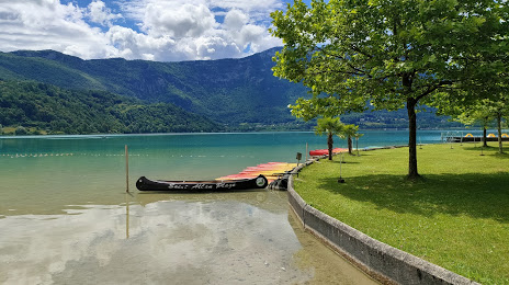
St Alban Plage - Plage, Pédalos, Canoës, Paddles on the map, Chambéry, France
Photo
Where is located St Alban Plage - Plage, Pédalos, Canoës, Paddles
St Alban Plage - Plage, Pédalos, Canoës, Paddles — local attraction, which is located at 15 Rte du Lac, 73610 Saint-Alban-de-Montbel, France and belongs to the category — water park. Average visitor rating for this place — 4.0 (according to 483 ratings, information from open sources and relevant for 2022).
Exact location — St Alban Plage - Plage, Pédalos, Canoës, Paddles, marked on the map with a red marker.
You can get directions to St Alban Plage - Plage, Pédalos, Canoës, Paddles on the map from your location.
What else is interesting in Chambéry? You can see all the sights if you go to the city page.
Coordinates
St Alban Plage - Plage, Pédalos, Canoës, Paddles, France coordinates in decimal format: latitude — 45.56238317689359, longitude — 5.796048625110169. When converted to degrees, minutes, seconds St Alban Plage - Plage, Pédalos, Canoës, Paddles has the following coordinates: 45°33′44.58 north latitude and 5°47′45.78 east longitude.
Nearby cities
The largest cities that are located nearby:
- Grenoble — 44 km
- Geneva
 (Switzerland) — 72 km
 - Villeurbanne — 83 km
- Lyon — 86 km
- Lausanne (Switzerland) — 119 km
- Saint-Étienne — 120 km
- Turin
 (Italy) — 149 km
 - Besançon — 185 km
- Bern (Switzerland) — 191 km
- Dijon — 205 km
- Novara (Italy) — 210 km
- Clermont-Ferrand — 220 km
- Nimes — 228 km
- Aix-en-Provence — 228 km
- Nice — 231 km
- Milan (Italy) — 254 km
- Basel (Switzerland) — 254 km
- Marseille — 255 km
- Monza (Italy) — 260 km
Distance to the capital
Distance to the capital (Paris) is about — 449 km.