
 Maureville
Samoëns
Gréning
Toulouse
Volx
Goudet
Méhoncourt
Saint-Hymer
Pontcarré
Maureville
Samoëns
Gréning
Toulouse
Volx
Goudet
Méhoncourt
Saint-Hymer
Pontcarré
Parc des Trinitaires on the map, Valence, France
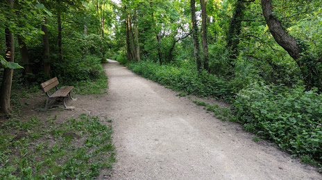
Photo
Where is located Parc des Trinitaires
Parc des Trinitaires — local attraction, which is located at Foret des Trinitaires, 26000 Valence, France and belongs to the category — national forest. Average visitor rating for this place — 4.2 (according to 174 ratings, information from open sources and relevant for 2022).
Exact location — Parc des Trinitaires, marked on the map with a red marker.
You can get directions to Parc des Trinitaires on the map from your location.
What else is interesting in Valence? You can see all the sights if you go to the city page.
Coordinates
Parc des Trinitaires, France coordinates in decimal format: latitude — 44.92131839331271, longitude — 4.882211725088788. When converted to degrees, minutes, seconds Parc des Trinitaires has the following coordinates: 44°55′16.75 north latitude and 4°52′55.96 east longitude.
Nearby cities
The largest cities that are located nearby:
- Saint-Étienne — 68 km
- Grenoble — 71 km
- Lyon — 92 km
- Villeurbanne — 93 km
- Nimes — 128 km
- Aix-en-Provence — 161 km
- Montpellier — 167 km
- Clermont-Ferrand — 168 km
- Geneva
 (Switzerland) — 169 km
 - Marseille — 185 km
- Toulon — 217 km
- Turin
 (Italy) — 219 km
 - Lausanne (Switzerland) — 220 km
- Nice — 233 km
- Dijon — 264 km
- Besançon — 269 km
- Bern (Switzerland) — 294 km
- Novara (Italy) — 295 km
- Perpignan — 297 km
Distance to the capital
Distance to the capital (Paris) is about — 478 km.