
 Maureville
Samoëns
Gréning
Toulouse
Volx
Goudet
Méhoncourt
Saint-Hymer
Pontcarré
Maureville
Samoëns
Gréning
Toulouse
Volx
Goudet
Méhoncourt
Saint-Hymer
Pontcarré
Parc Heller on the map, Massy, France
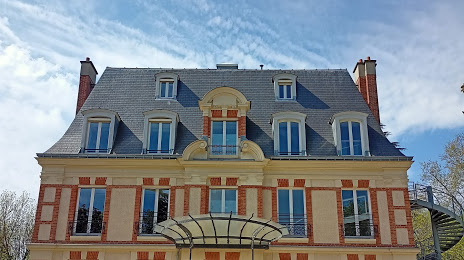
Photo
Where is located Parc Heller
Parc Heller — local attraction, which is located at Rue Gérard de Nerval, 92160 Antony, France and belongs to the category — park. Average visitor rating for this place — 4.4 (according to 1584 ratings, information from open sources and relevant for 2022).
Exact location — Parc Heller, marked on the map with a red marker.
You can get directions to Parc Heller on the map from your location.
What else is interesting in Massy? You can see all the sights if you go to the city page.
Coordinates
Parc Heller, France coordinates in decimal format: latitude — 48.746552344044034, longitude — 2.2897887252198634. When converted to degrees, minutes, seconds Parc Heller has the following coordinates: 48°44′47.59 north latitude and 2°17′23.24 east longitude.
Nearby cities
The largest cities that are located nearby:
- Boulogne-Billancourt — 12 km
- Orléans — 95 km
- Rouen — 115 km
- Amiens — 129 km
- Reims — 140 km
- Le Mans — 173 km
- Le Havre — 177 km
- Tours — 190 km
- Caen — 197 km
- Lille — 217 km
- Charleroi
 (Belgium) — 241 km
 - Angers — 253 km
- Dijon — 260 km
- Eastbourne
 (United Kingdom) — 264 km
 - Namur (Belgium) — 265 km
- Brussels (Belgium) — 276 km
- Nancy — 286 km
- Metz — 286 km
- Rennes — 299 km
Distance to the capital
Distance to the capital (Paris) is about — 13 km.